Latitude: 52.0019 / 52°0'6"N
Longitude: -2.1628 / 2°9'45"W
OS Eastings: 388922
OS Northings: 233734
OS Grid: SO889337
Mapcode National: GBR 1JK.D1G
Mapcode Global: VH93M.GYH6
Plus Code: 9C4V2R2P+QV
Entry Name: Turnpike Shelter at East End of Mythe Bridge
Listing Date: 27 July 1973
Last Amended: 25 April 1994
Grade: II
Source: Historic England
Source ID: 1201165
English Heritage Legacy ID: 376566
ID on this website: 101201165
Location: The Mythe, Tewkesbury, Gloucestershire, GL20
County: Gloucestershire
District: Tewkesbury
Civil Parish: Tewkesbury
Traditional County: Gloucestershire
Lieutenancy Area (Ceremonial County): Gloucestershire
Church of England Parish: Tewkesbury St Mary the Virgin (Tewkesbury Abbey)
Church of England Diocese: Gloucester
TEWKESBURY
SO83SE A438, The Mythe 859-1/2/390 (East side) 27/07/73 Turnpike shelter at east end of Mythe Bridge (Formerly Listed as: THE MYTHE Turnpike Shelter (facing the Tollhouse) Mythe Bridge)
GV II
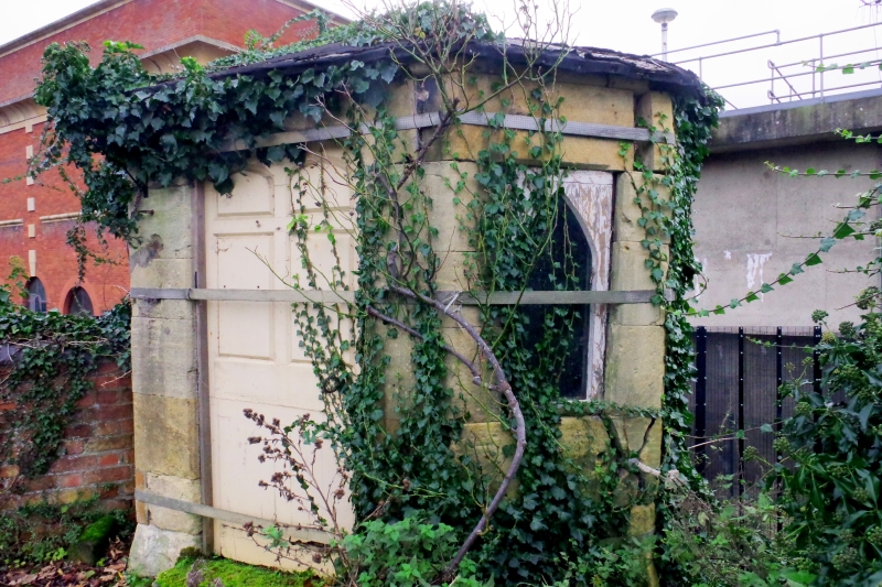
Shelter for toll keeper. 1826. Probably from Telford's studio. Sandstone, slate roof. A small polygonal structure at the downstream side of bridge at its E end, opposite the Toll House (qv). It is carried down to lower bank level beyond roadway; heavily overgrown at time of survey (July 1991). The work above road level is in ashlar, but below is coursed lias. A central panelled door in 4-centred arch is flanked on splays by small side lights. Hipped roof. The former toll gates reputed to be at Bredon, Worcs.
Listing NGR: SO8892233734
External links are from the relevant listing authority and, where applicable, Wikidata. Wikidata IDs may be related buildings as well as this specific building. If you want to add or update a link, you will need to do so by editing the Wikidata entry.


Other nearby listed buildings