Latitude: 51.9926 / 51°59'33"N
Longitude: -2.1574 / 2°9'26"W
OS Eastings: 389286
OS Northings: 232692
OS Grid: SO892326
Mapcode National: GBR 1JR.1C6
Mapcode Global: VH93T.K59T
Plus Code: 9C3VXRVV+22
Entry Name: 156, High Street
Listing Date: 4 March 1952
Grade: II
Source: Historic England
Source ID: 1201275
English Heritage Legacy ID: 376859
ID on this website: 101201275
Location: Tewkesbury, Gloucestershire, GL20
County: Gloucestershire
District: Tewkesbury
Civil Parish: Tewkesbury
Built-Up Area: Tewkesbury
Traditional County: Gloucestershire
Lieutenancy Area (Ceremonial County): Gloucestershire
Church of England Parish: Tewkesbury St Mary the Virgin (Tewkesbury Abbey)
Church of England Diocese: Gloucester
Tagged with: Building
TEWKESBURY
SO8932 HIGH STREET 859-1/6/278 (East side) 04/03/52 No.156
GV II
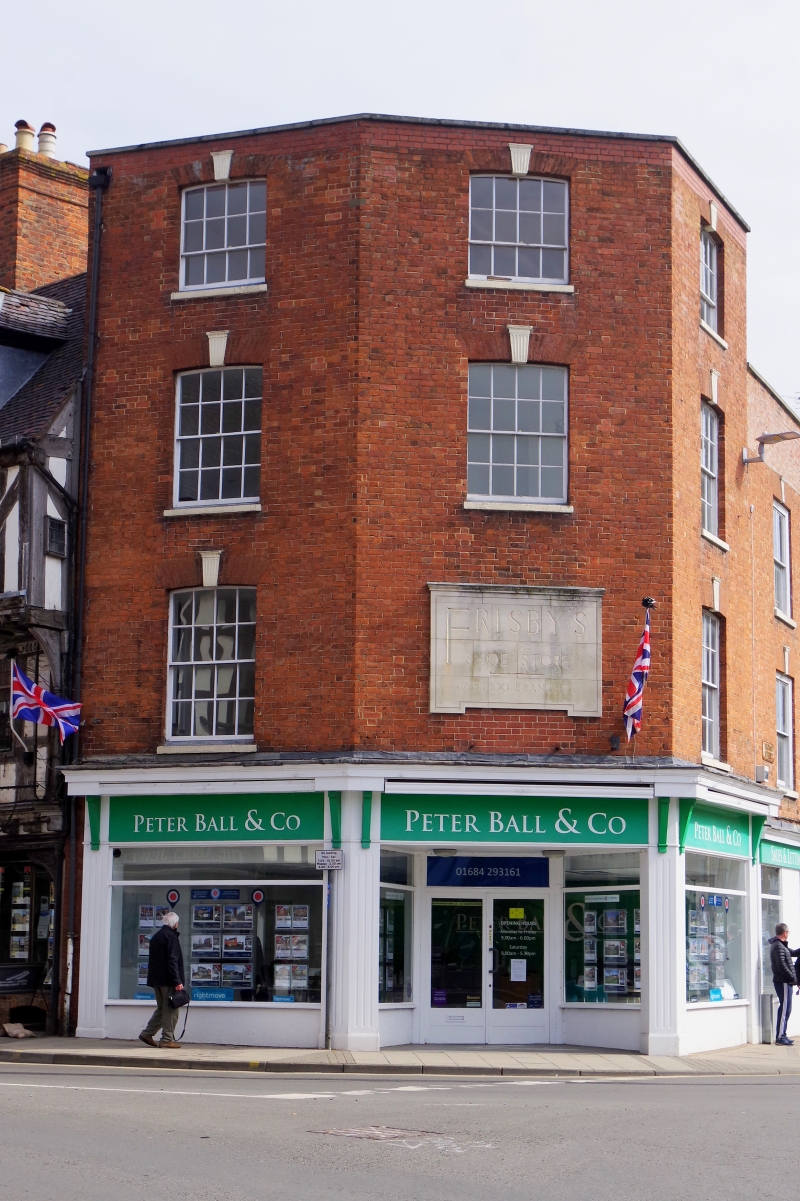
House at junction of two principal streets, with shop. Early C19 facade, some C18 interior detail. Flemish bond brickwork, slate roof, brick stacks. A tall building with a splayed corner, and parapet cropped close to third-floor window heads; the property links the last building in the main run in High Street with the first in Barton Street. 4 storeys, 1:1:1-windowed. 12-pane (horizontal) sash at third floor, above 16-pane at first and second floors, all to brick voussoirs and central fluted keystone with cornice. C20 plate-glass shop front to each facet, with deep-set doors on splay front. A large stone panel inscribed 'Frisby's' has replaced the central first-floor window. INTERIOR, which links with No.1, Barton Street (qv), is very simple, with remnants of contemporary stick-baluster staircases, and 2 blocked fireplaces, one of these with eared architrave. This building is a key element in the townscape at the junction of the three main streets, The Cross; the top courses of the walling, just below the parapet, are a rebuilding. A 1960 photograph in the NMR shows the first-floor splay to have a glazing-bar sash where the inscribed panel is located. (Photograph in National Monuments Record: 1960-).
Listing NGR: SO8929032695
External links are from the relevant listing authority and, where applicable, Wikidata. Wikidata IDs may be related buildings as well as this specific building. If you want to add or update a link, you will need to do so by editing the Wikidata entry.


Other nearby listed buildings