Approximate Location Map
Large Map »
Latitude: 50.2642 / 50°15'51"N
Longitude: -5.0501 / 5°3'0"W
OS Eastings: 182715
OS Northings: 44923
OS Grid: SW827449
Mapcode National: GBR ZF.XGM2
Mapcode Global: FRA 089B.JC7
Plus Code: 9C2P7W7X+MX
Entry Name: Old Bridge over River Allen
Listing Date: 19 June 1973
Grade: II
Source: Historic England
Source ID: 1201506
English Heritage Legacy ID: 377519
ID on this website: 101201506
Location: Truro, Cornwall, TR1
County: Cornwall
Civil Parish: Truro
Built-Up Area: Truro
Traditional County: Cornwall
Lieutenancy Area (Ceremonial County): Cornwall
Church of England Parish: St John and St Paul, Truro
Church of England Diocese: Truro
Tagged with: Road bridge
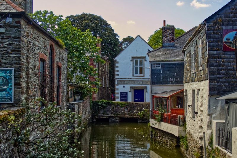
TRURO
SW8244NE OLD BRIDGE STREET
880-1/7/206 (North side)
19/06/73 "Old Bridge" over River Allen
GV II
Road bridge over river. Probably C18. Rubble, with render at
west upstream end with 2 elliptical arches and cutwater, and
lintelled openings to other end.
Listing NGR: SW8271544923
External links are from the relevant listing authority and, where applicable, Wikidata. Wikidata IDs may be related buildings as well as this specific building. If you want to add or update a link, you will need to do so by editing the Wikidata entry.


Other nearby listed buildings
