Latitude: 53.5423 / 53°32'32"N
Longitude: -2.1119 / 2°6'42"W
OS Eastings: 392683
OS Northings: 405078
OS Grid: SD926050
Mapcode National: GBR FWPG.LX
Mapcode Global: WHB9B.J7K7
Plus Code: 9C5VGVRQ+W7
Entry Name: 10-14, Church Lane
Listing Date: 23 January 1973
Grade: II
Source: Historic England
Source ID: 1201708
English Heritage Legacy ID: 388882
ID on this website: 101201708
Location: Oldham, Greater Manchester, OL1
County: Oldham
Electoral Ward/Division: St Mary's
Parish: Non Civil Parish
Built-Up Area: Oldham
Traditional County: Lancashire
Lieutenancy Area (Ceremonial County): Greater Manchester
Church of England Parish: Oldham St Mary with St Peter
Church of England Diocese: Manchester
Tagged with: Building
OLDHAM
SD9205SE CHURCH LANE 780-1/5/20 (South side) 23/01/73 Nos.10, 12 AND 14
GV II
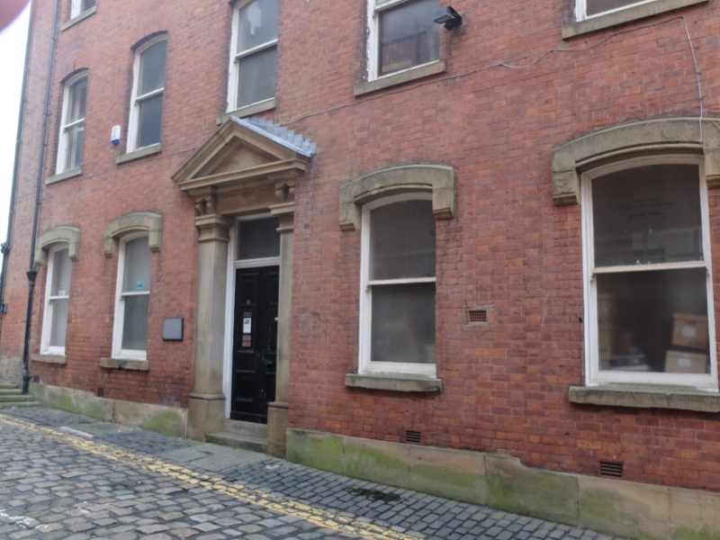
Terrace of 3 houses, now in commercial use. c1880. Brick with Welsh slate roof, and white glazed brick to rear elevations. Tall 3-storeyed 11-window range. 3 doorways in stone pedimented architraves recessed into wall. Lower 2-pane sash windows have stilted stone hood moulds and stone sills. Upper windows have cambered brick arched heads and stone sills. Plain wood eaves cornice. End wall stacks, partially truncated.
Listing NGR: SD9268305078
External links are from the relevant listing authority and, where applicable, Wikidata. Wikidata IDs may be related buildings as well as this specific building. If you want to add or update a link, you will need to do so by editing the Wikidata entry.


Other nearby listed buildings