Latitude: 53.5424 / 53°32'32"N
Longitude: -2.1121 / 2°6'43"W
OS Eastings: 392667
OS Northings: 405091
OS Grid: SD926050
Mapcode National: GBR FWPG.JW
Mapcode Global: WHB9B.J7G4
Plus Code: 9C5VGVRQ+X5
Entry Name: 11, Church Lane
Listing Date: 23 January 1973
Last Amended: 8 March 1993
Grade: II
Source: Historic England
Source ID: 1210120
English Heritage Legacy ID: 388883
ID on this website: 101210120
Location: Oldham, Greater Manchester, OL1
County: Oldham
Electoral Ward/Division: St Mary's
Parish: Non Civil Parish
Built-Up Area: Oldham
Traditional County: Lancashire
Lieutenancy Area (Ceremonial County): Greater Manchester
Church of England Parish: Oldham St Mary with St Peter
Church of England Diocese: Manchester
Tagged with: Building
OLDHAM
SD9205SE CHURCH LANE 780-1/5/21 (North side) 23/01/73 No.11 (Formerly Listed as: CHURCH LANE Nos.7-11 (Odd))
GV II
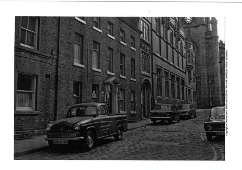
House, formerly in use as offices but vacant at time of inspection. c1800. Brick with stone dressings and Welsh slate roof. 3 storeys, symmetrical 5-window range with central entrance. Door in Tuscan pedimented case with plain fanlight. 2-pane sash windows, some renewed in original openings, with flat arched gauged brick heads and stone sills. 6-paned sashes to attic storey. Stone eaves band.
Listing NGR: SD9266705091
External links are from the relevant listing authority and, where applicable, Wikidata. Wikidata IDs may be related buildings as well as this specific building. If you want to add or update a link, you will need to do so by editing the Wikidata entry.


Other nearby listed buildings