Latitude: 52.5882 / 52°35'17"N
Longitude: -2.1221 / 2°7'19"W
OS Eastings: 391823
OS Northings: 298938
OS Grid: SO918989
Mapcode National: GBR 1FJ.ML
Mapcode Global: WHBFZ.C6QN
Plus Code: 9C4VHVQH+75
Entry Name: Canal footbridge at entrance to Broad Street Basin
Listing Date: 3 February 1977
Last Amended: 31 March 1992
Grade: II
Source: Historic England
Source ID: 1201895
English Heritage Legacy ID: 378633
ID on this website: 101201895
Location: Wolverhampton, West Midlands, WV1
County: City of Wolverhampton
Electoral Ward/Division: Heath Town
Parish: Non Civil Parish
Built-Up Area: Wolverhampton
Traditional County: Staffordshire
Lieutenancy Area (Ceremonial County): West Midlands
Church of England Parish: Central Wolverhampton
Church of England Diocese: Lichfield
Tagged with: Footbridge
This list entry was subject to a Minor Amendment on 28 August 2025 to correct a typo in the name and address and to reformat the text to current standards
SO9198NE
895-1/12/352
WOLVERHAMPTON
WEDNESFIELD ROAD (South side)
Canal footbridge at entrance to Broad St Basin
(Formerly Listed as: BROAD STREET (South side) Canal footbridge 25m south of Broad Street Bridge)
03/02/77
GV
II
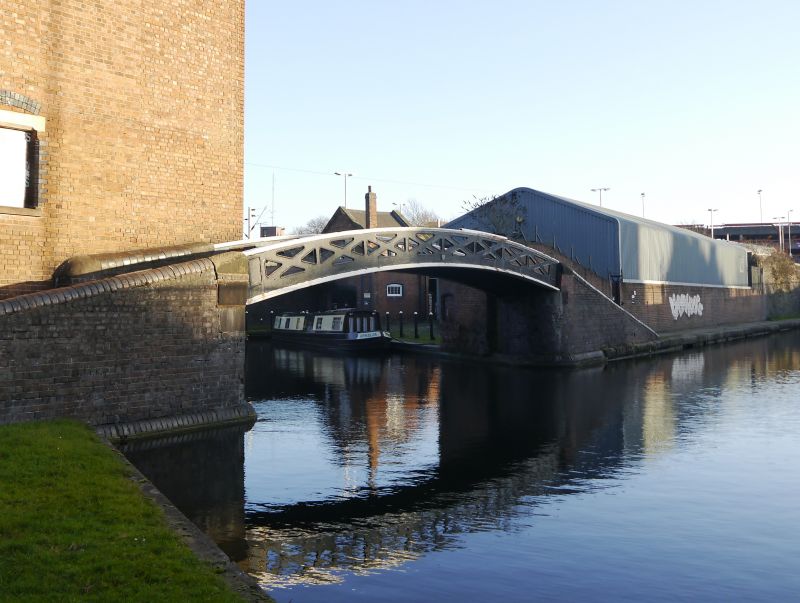
Canal footbridge. c1850. Brick and cast iron. Segmental arch with low lattice work parapets, cast in one piece; brick abutments and ramps to each side. Approximately 40m long and 2.5m wide. Built to take towpath over branch of Birmingham Canal (Wolverhampton level).
Listing NGR: SO9182398938
External links are from the relevant listing authority and, where applicable, Wikidata. Wikidata IDs may be related buildings as well as this specific building. If you want to add or update a link, you will need to do so by editing the Wikidata entry.


Other nearby listed buildings