Latitude: 52.5887 / 52°35'19"N
Longitude: -2.1213 / 2°7'16"W
OS Eastings: 391876
OS Northings: 298993
OS Grid: SO918989
Mapcode National: GBR 1FJ.SD
Mapcode Global: WHBFZ.D628
Plus Code: 9C4VHVQH+FF
Entry Name: Wednesfield Road High Level Railway Bridge
Listing Date: 20 February 1987
Grade: II
Source: Historic England
Source ID: 1208890
English Heritage Legacy ID: 378637
ID on this website: 101208890
Location: Wolverhampton, West Midlands, WV1
County: City of Wolverhampton
Electoral Ward/Division: Heath Town
Parish: Non Civil Parish
Built-Up Area: Wolverhampton
Traditional County: Staffordshire
Lieutenancy Area (Ceremonial County): West Midlands
Church of England Parish: Central Wolverhampton
Church of England Diocese: Lichfield
Tagged with: Railway bridge
WOLVERHAMPTON
SO9198NE WEDNESFIELD ROAD 895-1/12/356 Wednesfield Road High Level Railway 20/02/87 Bridge
GV II
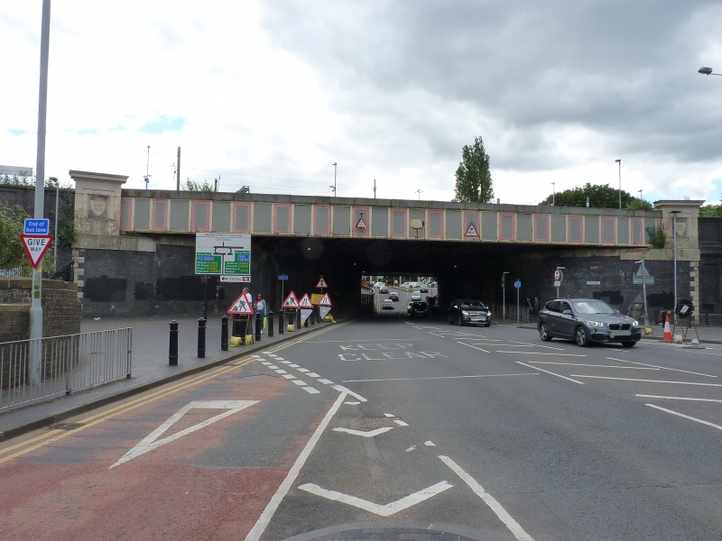
Railway underbridge to high level line. 1848; widened on north east side, c1870 and 1880. Brick abutments, ashlar dressings, rivetted cast- iron decking and beams. On the later, north-east, side the abutments curve round in quadrants which terminate in stone quoined angles against the faces of the adjoining retaining walls (q.v.). Above both quoined angles there is a large painted stone pedestal with cornice and a recessed panel on the outer face which contain a shield inscribed: A.D. 1880. Between the pedestals, a riveted cast-iron parapet in framed panels; in the central panel an oval cast iron plate with figures: 1880 in its centre, and lettering: ERECTED BY THE HORSELEY CO. LTD divided above and below, and HENRY WOODHOUSE above and ENGINEER below against rim of plate. Included for group value.
Listing NGR: SO9187698993
External links are from the relevant listing authority and, where applicable, Wikidata. Wikidata IDs may be related buildings as well as this specific building. If you want to add or update a link, you will need to do so by editing the Wikidata entry.


Other nearby listed buildings