Latitude: 51.457 / 51°27'25"N
Longitude: -2.6052 / 2°36'18"W
OS Eastings: 358049
OS Northings: 173282
OS Grid: ST580732
Mapcode National: GBR C5J.SK
Mapcode Global: VH88M.SMMY
Plus Code: 9C3VF94V+QW
Entry Name: University of Bristol, Geography Department
Listing Date: 30 December 1994
Grade: II
Source: Historic England
Source ID: 1202652
English Heritage Legacy ID: 380756
ID on this website: 101202652
Location: Tyndall's Park, Bristol, BS8
County: City of Bristol
Electoral Ward/Division: Central
Parish: Non Civil Parish
Built-Up Area: Bristol
Traditional County: Gloucestershire
Lieutenancy Area (Ceremonial County): Bristol
Church of England Parish: Clifton, St Paul
Church of England Diocese: Bristol
Tagged with: University building
BRISTOL
ST5873SW UNIVERSITY ROAD 901-1/10/315 (South East side) University of Bristol, Geography Department
GV II
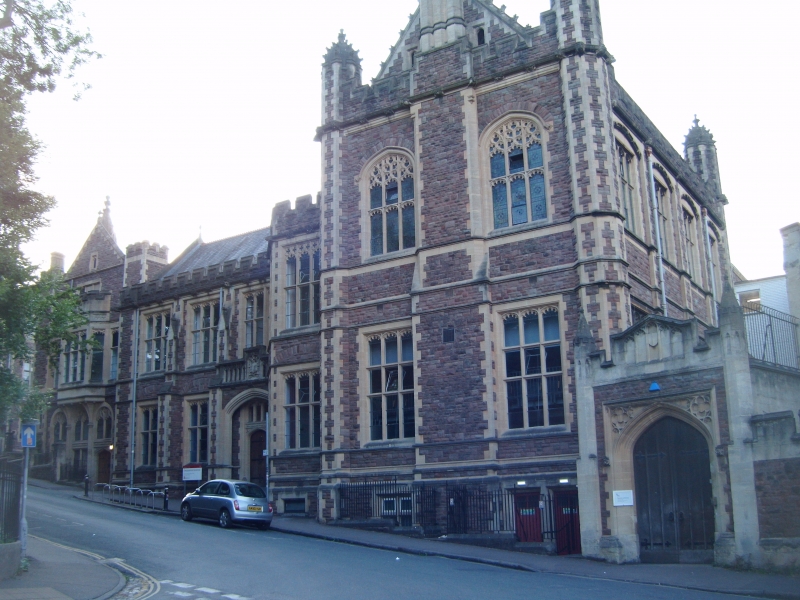
University department. 1892. By F Bligh Bond. Red Pennant rubble with limestone dressings, gable stacks and a slate roof. L-shaped double-depth plan. Collegiate Tudor Gothic Revival style. 2 storeys and basement; 6-window range. A 2-window gable, 3-window block to left and canted bay in the angle. Moulded plinth, sill and lintel string courses, cornice with carved heads and gargoyles and crenellated parapet, with coped gables. Front right-hand gable has clasping octagonal buttresses to cyma pepperpots with large crockets; 3-light mullion and transom windows, with cinquefoil heads on the ground floor, and curvilinear tracery to the first floor, flank an exterior chimney breast with 3 octagonal ashlar stacks to a crocketed gable. Similar windows as the ground floor to the remainder, separated by buttresses, with a Tudor-arched doorway in the right-hand bay under a 2-centred arch with an open work parapet above. Full-height canted bay in the re-entrant. INTERIOR: largely rebuilt mid C20 after a fire. Open-well stair with moulded rail. Originally the Medical School, and part of the first buildings for the new university designed by C Hansom, and adapted after his death by Bond. (Gomme A, Jenner M and Little B: Bristol, An Architectural History: Bristol: 1979-: 323; Crick C: Victorian Buildings in Bristol: Bristol: 1975-: 58).
Listing NGR: ST5804973282
External links are from the relevant listing authority and, where applicable, Wikidata. Wikidata IDs may be related buildings as well as this specific building. If you want to add or update a link, you will need to do so by editing the Wikidata entry.


Other nearby listed buildings