Latitude: 51.9929 / 51°59'34"N
Longitude: -2.155 / 2°9'18"W
OS Eastings: 389452
OS Northings: 232725
OS Grid: SO894327
Mapcode National: GBR 1JR.1YQ
Mapcode Global: VH93T.L5LL
Plus Code: 9C3VXRVV+4X
Entry Name: 29, Barton Street
Listing Date: 4 March 1952
Last Amended: 25 April 1994
Grade: II
Source: Historic England
Source ID: 1204825
English Heritage Legacy ID: 376612
ID on this website: 101204825
Location: Tewkesbury, Gloucestershire, GL20
County: Gloucestershire
District: Tewkesbury
Civil Parish: Tewkesbury
Built-Up Area: Tewkesbury
Traditional County: Gloucestershire
Lieutenancy Area (Ceremonial County): Gloucestershire
Church of England Parish: Tewkesbury Holy Trinity
Church of England Diocese: Gloucester
Tagged with: Building
TEWKESBURY
SO8989 BARTON STREET 859-1/6/26 (North side) 04/03/52 No.29 (Formerly Listed as: BARTON STREET (North side) Nos.29 AND 30)
GV II
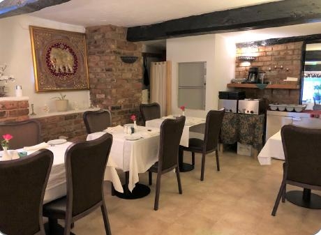
Restaurant, former house in row. Late C15 or C16 with C18 front. Painted brick, timber frame, tile roof, brick stack. PLAN: a long narrow block with steep-pitched roof, probably built at the same time as No.30 (qv), adjoining, with which it interlocks at the back; large central stack at rear eaves. EXTERIOR: 2 storeys and attic, 2-windowed. C18 two-light gabled dormer above 2 deep-set 12-pane sashes to stone cills, and a C19 pilaster shop front, with a 4-panel part-glazed door to left. On the return gable to left, exposed by the setting-back of the late C20 police station, is a small attic window, set into the exposed framing, which appears to belong to the demolished building rather than to No.29. A large square brick stack rises from the rear eaves position. INTERIOR: much of the principal framing survives. The main front space has very heavy square panel work with a very large transverse beam at the centre, with 150mm chamfer, carried on an extremely deep plate beam in wall. Back right, in slight offset from the forward space, opening with remains of reset C15 doorway with spandrel carving, and a superimposed ogee-bracket, and large corner post. Fireplace, partly concealed by later fittings, has fine 4-centred stone moulded surround to stops with spandrels. Lower back room also has large chamfered transverse beams and framed rear wall. In room above, now (1992) the kitchen, the heavy framing is cross-braced. The first-floor front room has fine framed party walls, small transverse beam, and C19 fireplace. Original clasped-purlin roof replaced in C18; C15 queen-post truss to right, C16 two-bay clasped purlin collar-truss roof to rear. This structure, concealed behind an unprepossessing later facade, is characteristic of the small-scale early framed buildings in the town. The evidence for doorways on the right gable walls at ground- and first-floor levels suggests that the original medieval house was larger and probably included a now demolished hall to the right.
Listing NGR: SO8945232724
External links are from the relevant listing authority and, where applicable, Wikidata. Wikidata IDs may be related buildings as well as this specific building. If you want to add or update a link, you will need to do so by editing the Wikidata entry.


Other nearby listed buildings