Latitude: 51.9929 / 51°59'34"N
Longitude: -2.1548 / 2°9'17"W
OS Eastings: 389470
OS Northings: 232727
OS Grid: SO894327
Mapcode National: GBR 1JR.216
Mapcode Global: VH93T.L5QL
Plus Code: 9C3VXRVW+53
Entry Name: 33 and 33A, Barton Street
Listing Date: 4 March 1952
Last Amended: 25 April 1994
Grade: II
Source: Historic England
Source ID: 1281031
English Heritage Legacy ID: 376616
ID on this website: 101281031
Location: Tewkesbury, Gloucestershire, GL20
County: Gloucestershire
District: Tewkesbury
Civil Parish: Tewkesbury
Built-Up Area: Tewkesbury
Traditional County: Gloucestershire
Lieutenancy Area (Ceremonial County): Gloucestershire
Church of England Parish: Tewkesbury Holy Trinity
Church of England Diocese: Gloucester
Tagged with: Building
TEWKESBURY
SO8932 BARTON STREET 859-1/6/30 (North side) 04/03/52 Nos.33 AND 33A (Formerly Listed as: BARTON STREET (North side) No.33)
GV II
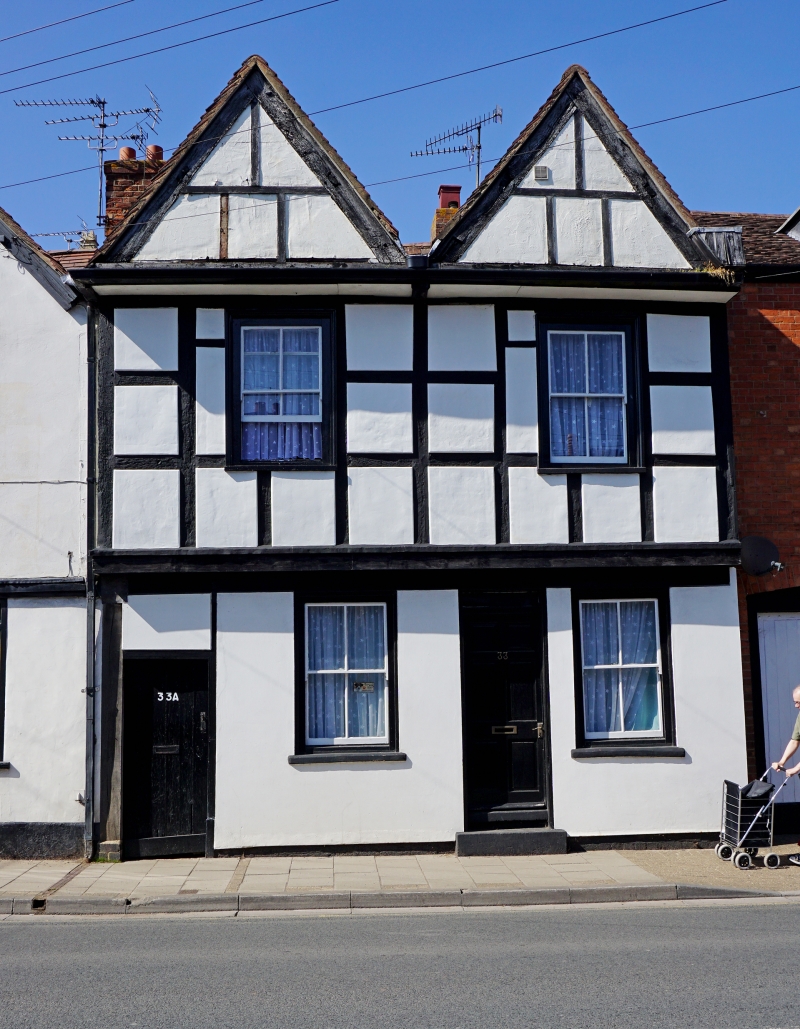
Pair of houses in row. Early/mid C17. Small square panel timber-frame, plastered panels and underbuild, tile roof, brick stacks. Side-entry right angle plan gabled to street. Double-jettied, twin gables to street, throughway underneath, to left; C20 gabled wing to back. 2 storeys and attic, 1+1-windowed. All 4-pane sashes in moulded architraves. To left is low opening with early plank door (No.33A), and between ground-floor windows a 6-panel door (No.33) under shallow transom-light on one step. Moulded cornice under gables, which may have had central small casements. In the throughway is an early plank door, to No.33A, and remains of timber-framing in the wall. 2 brick stacks to back, and a gabled dormer. INTERIOR not inspected.
Listing NGR: SO8947032727
External links are from the relevant listing authority and, where applicable, Wikidata. Wikidata IDs may be related buildings as well as this specific building. If you want to add or update a link, you will need to do so by editing the Wikidata entry.


Other nearby listed buildings