Latitude: 51.9948 / 51°59'41"N
Longitude: -2.1569 / 2°9'24"W
OS Eastings: 389323
OS Northings: 232940
OS Grid: SO893329
Mapcode National: GBR 1JK.TRX
Mapcode Global: VH93T.K4L3
Plus Code: 9C3VXRVV+W6
Entry Name: 36, High Street
Listing Date: 4 March 1952
Grade: II
Source: Historic England
Source ID: 1206445
English Heritage Legacy ID: 376786
ID on this website: 101206445
Location: Tewkesbury, Gloucestershire, GL20
County: Gloucestershire
District: Tewkesbury
Civil Parish: Tewkesbury
Built-Up Area: Tewkesbury
Traditional County: Gloucestershire
Lieutenancy Area (Ceremonial County): Gloucestershire
Church of England Parish: Tewkesbury St Mary the Virgin (Tewkesbury Abbey)
Church of England Diocese: Gloucester
Tagged with: Building
TEWKESBURY
SO8932 HIGH STREET 859-1/6/203 (West side) 04/03/52 No.36
GV II
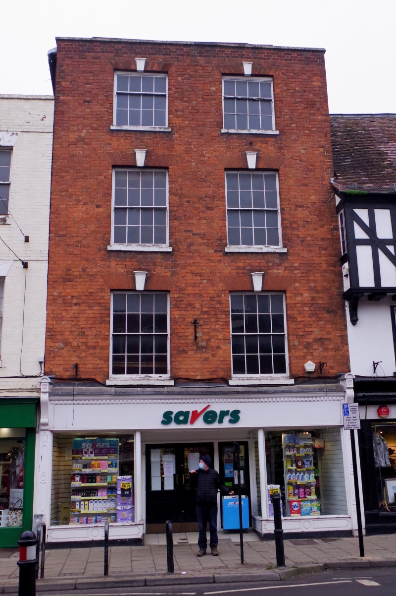
House in row. Early C19. Flemish bond brickwork, roof not visible behind parapet. A narrow-frontage 4-storey, 2-windowed building. Wide 12-pane above 16-pane sashes with brick voussoirs and fluted keystone with cornice, stone cills. Full-width late C19 pilaster shop front with consoles to a deep fascia with moulded cornice, panelled stall-risers. Central panelled and glazed doors set well back. The coped parapet returns to the sides. INTERIOR not inspected. The building appears to have been a complete rebuild of early C19, but was also being reconstructed behind the facade in 1971 at the time of the previous survey. The ground floor does not retain any early features.
Listing NGR: SO8932332940
External links are from the relevant listing authority and, where applicable, Wikidata. Wikidata IDs may be related buildings as well as this specific building. If you want to add or update a link, you will need to do so by editing the Wikidata entry.


Other nearby listed buildings