Latitude: 51.1962 / 51°11'46"N
Longitude: -3.4664 / 3°27'58"W
OS Eastings: 297635
OS Northings: 145127
OS Grid: SS976451
Mapcode National: GBR LJ.4ZLV
Mapcode Global: VH5K4.V6TC
Plus Code: 9C3R5GWM+FF
Entry Name: The Old Presbytery, Corner Cottage and Rear Walls to the Old Presbytery
Listing Date: 28 October 1976
Last Amended: 30 September 1994
Grade: II
Source: Historic England
Source ID: 1206977
English Heritage Legacy ID: 391165
ID on this website: 101206977
Location: Alcombe, Somerset, TA24
County: Somerset
District: Somerset West and Taunton
Civil Parish: Minehead
Built-Up Area: Minehead
Traditional County: Somerset
Lieutenancy Area (Ceremonial County): Somerset
Tagged with: Cottage
MINEHEAD
SS9745 CHURCH STREET, Alcombe 900-1/4/131 (East side) 28/10/76 The Old Presbytery, Corner Cottage and rear walls to The Old Presbytery (Formerly Listed as: CHURCH STREET, Alcombe (East side) St Austell House, The Old Presbytery, Corner Cottage and Manoah)
GV II
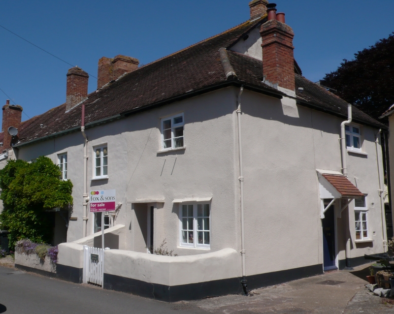
2 cottages, probably formerly one older house. C18 with early C19 alteration and fenestration. Painted render over rubblestone, crested plain tile roof with exposed rafter ends, hipped with a gablet to the right, brick stacks to gable ends, left front slope and right eaves. Double-depth plan. 2 storeys; 4-window range. Corner Cottage occupies the range to the right with entrances to the front and right return. C20 two-light casement windows. The Presbytery is a virtually symmetrical 3-window range to Church Street with a tiled lean-to porch to the centre. 2-light casement windows to first floor, C19 two-light casement window to left of front door and a C20 window to the right. The rear is 3 storeys with three 3/6-pane sash windows to the second floor, 6/6-pane sashes to the first floor over a C19 tall 3-light window of 4 vertical panes to each leaf below to the right. INTERIOR: a through passage and a studded wall to the left of it (now covered) indicate that this was probably formerly a 3-unit-plan house. The C19 three-light window to the ground floor has panelled shutters; a C18 staircase with fretted ends and traces of former stick balusters remain. SUBSIDIARY FEATURES: attached high rubblestone walls approx 40m long to each side of the tapered rear garden terminate at a rubblestone outhouse approx 3m x 3.5m.
Listing NGR: SS9763545127
External links are from the relevant listing authority and, where applicable, Wikidata. Wikidata IDs may be related buildings as well as this specific building. If you want to add or update a link, you will need to do so by editing the Wikidata entry.


Other nearby listed buildings