Latitude: 54.9193 / 54°55'9"N
Longitude: -1.3679 / 1°22'4"W
OS Eastings: 440613
OS Northings: 558470
OS Grid: NZ406584
Mapcode National: GBR VFS.FT
Mapcode Global: WHD55.YMS5
Plus Code: 9C6WWJ9J+PR
Entry Name: Remaining Walls of North Dock
Listing Date: 10 November 1978
Grade: II
Source: Historic England
Source ID: 1207085
English Heritage Legacy ID: 391471
ID on this website: 101207085
Location: Roker, Sunderland, Tyne and Wear, SR6
County: Sunderland
Electoral Ward/Division: St Peter's
Parish: Non Civil Parish
Built-Up Area: Sunderland
Traditional County: Durham
Lieutenancy Area (Ceremonial County): Tyne and Wear
Church of England Parish: Monkwearmouth Team Ministry
Church of England Diocese: Durham
Tagged with: Wall
SUNDERLAND
NZ4058 HARBOUR VIEW 920-1/9/96 (East side (off)) 10/11/78 Remaining walls of North Dock
GV II
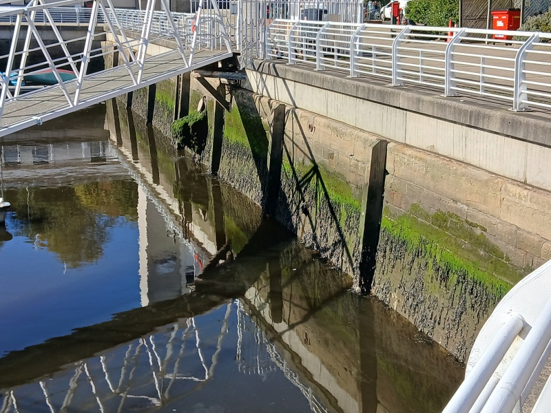
The remaining walls of a 6-acre dock. 1834-38. By Isambard Kingdom Brunel. For the Wearmouth Dock Company by Royal Charter. Opened for traffic 1837; 1846 purchased by York and Newcastle Railway Co.; sold by NE Railway in 1922; by 1934 the property of the River Wear Commissioners. Granite ashlar. All the NW, much of the SW and NE, and part of the SE walls of what was originally a square-plan dock with entrance lock gates from tide basin at south. High wall with curved batter and bull-nosed edging; vertical timber buffer strips set in at intervals. Construction was by building one course of back and front walls at a time, filling space with mortar and setting core stones within that mortar so as to ensure a completely solid structure. Part of NE and SE walls survive behind late-C20 landfill. Part of SE wall demolished together with entrance. A significant structure by one of the greatest engineers of the C19. (Corfe T: The Buildings of Sunderland 1814-1914.: Newcastle upon Tyne: 1983-: 18; ).
Listing NGR: NZ4061358469
External links are from the relevant listing authority and, where applicable, Wikidata. Wikidata IDs may be related buildings as well as this specific building. If you want to add or update a link, you will need to do so by editing the Wikidata entry.


Other nearby listed buildings