Latitude: 54.9165 / 54°54'59"N
Longitude: -1.3632 / 1°21'47"W
OS Eastings: 440920
OS Northings: 558159
OS Grid: NZ409581
Mapcode National: GBR VGH.0K
Mapcode Global: WHD56.1P4B
Plus Code: 9C6WWJ8P+HP
Entry Name: Wave Basin Battery Adjacent to Old South Pier
Listing Date: 26 November 1990
Last Amended: 17 October 1994
Grade: II
Source: Historic England
Source ID: 1207135
English Heritage Legacy ID: 391604
ID on this website: 101207135
Location: Sunderland, Tyne and Wear, SR6
County: Sunderland
Electoral Ward/Division: Hendon
Parish: Non Civil Parish
Built-Up Area: Sunderland
Traditional County: Durham
Lieutenancy Area (Ceremonial County): Tyne and Wear
Church of England Parish: Hendon
Church of England Diocese: Durham
Tagged with: Architectural structure Artillery battery
SUNDERLAND
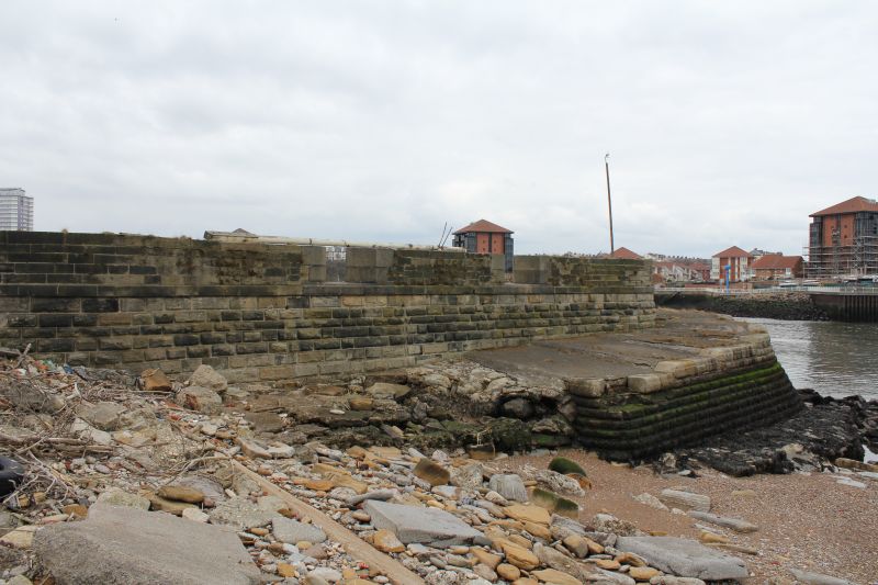
NZ4058 SUNDERLAND HARBOUR 920-1/9/215 (South side) 26/11/90 Wave Basin Battery adjacent to old South Pier (Formerly Listed as: SOUTH PIER Wave Basin Battery)
GV II
Battery. c1873. For the War Office on site given in 1860 by River Wear Commission. Ashlar. A mole projecting into the river inside the harbour, on the E side of the Wave Basin and immediately SW of old South Pier, with 4 gun emplacements. No.1 gun emplacement at the N, rounded end of the mole has had concrete filling added. The second and third emplacements have splayed openings to seaward in the battery wall, which is protected from the water by the breakwater of the mole. Nos 1 and 4 gun emplacements had an ashlar circle and a central ashlar block in which the central pivot was set; at least one pivot survives; these guns fired over over the parapet. Nos 2 and 3 had front pivot traversing carriages of either wood or wrought-iron. The original artillery consisted of four 80 pounder rifle muzzle loading guns. This is the one surviving example of an RML battery between the Humber and the Tweed. It is an important illustration of the transition from cannon to modern artillery, and also illustrates the methods used to defend mercantile ports in the years after the Crimean War and the production of iron-clad warships. It is shown on an 1875 official plan of Hudson Docks, reproduced in Sinclair 1986. (Fortress Study Group: Conference notes: Tyneside: 1988-; Sinclair NT: Railways of Sunderland: Newcastle upon Tyne: 1986-: 60).
Listing NGR: NZ4092058159
External links are from the relevant listing authority and, where applicable, Wikidata. Wikidata IDs may be related buildings as well as this specific building. If you want to add or update a link, you will need to do so by editing the Wikidata entry.


Other nearby listed buildings