Latitude: 54.8646 / 54°51'52"N
Longitude: -1.3722 / 1°22'19"W
OS Eastings: 440394
OS Northings: 552385
OS Grid: NZ403523
Mapcode National: GBR LDV5.QY
Mapcode Global: WHD5C.WZRL
Plus Code: 9C6WVJ7H+R4
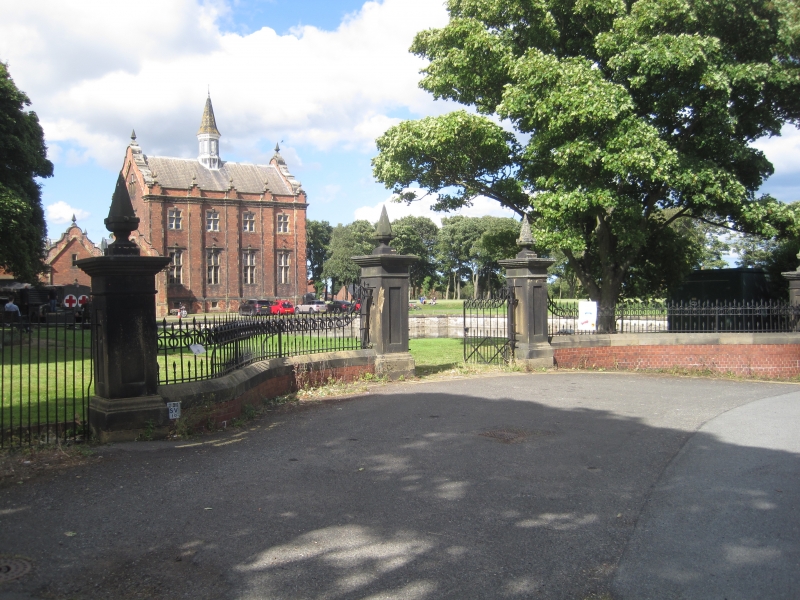
Entry Name: Walls, Piers, Gates and Railings South of Ryhope Pumping Station
Listing Date: 19 June 1974
Last Amended: 17 October 1994
Grade: II
Source: Historic England
Source ID: 1207134
English Heritage Legacy ID: 391602
ID on this website: 101207134
Location: Ryhope, Sunderland, Tyne and Wear, SR2
County: Sunderland
Electoral Ward/Division: Ryhope
Parish: Non Civil Parish
Built-Up Area: Sunderland
Traditional County: Durham
Lieutenancy Area (Ceremonial County): Tyne and Wear
Church of England Parish: Ryhope
Church of England Diocese: Durham
Tagged with: Wall
SUNDERLAND
NZ45SW STOCKTON ROAD, Ryhope 920-1/7/264 (West side (off)) 19/06/74 Walls, piers, gates and railings south of Ryhope Pumping Station (Formerly Listed as: RYHOPE Gate piers, gates and railings to S of main building at Ryhope Pumping Station) (Formerly Listed as: RYHOPE Forecourt wall to south of main building at Ryhope Pumping Station)
GV II
Walls, piers, gates and railings at original entrance to water pumping station. c1870. Header-bond brick and ashlar wall, ashlar piers, wrought-iron gates and railings. Low serpentine walls with chamfered ashlar coping flank gateway and terminate in 4 panelled ashlar piers each with plinth, cornice and obelisk finial. Ornamental gates, cross-braced, have dog bars; similar railings on walls are ramped to gate piers. Main entrance to site now transferred to W of superintendent's house.
Listing NGR: NZ4039452385
External links are from the relevant listing authority and, where applicable, Wikidata. Wikidata IDs may be related buildings as well as this specific building. If you want to add or update a link, you will need to do so by editing the Wikidata entry.


Other nearby listed buildings