Latitude: 51.4455 / 51°26'43"N
Longitude: -2.6002 / 2°36'0"W
OS Eastings: 358386
OS Northings: 172003
OS Grid: ST583720
Mapcode National: GBR C6N.XP
Mapcode Global: VH88M.WX8S
Plus Code: 9C3VC9WX+5W
Entry Name: 69-78, Coronation Road
Listing Date: 30 December 1994
Grade: II
Source: Historic England
Source ID: 1207508
English Heritage Legacy ID: 379401
ID on this website: 101207508
Location: Southville, Bristol, BS3
County: City of Bristol
Electoral Ward/Division: Southville
Parish: Non Civil Parish
Built-Up Area: Bristol
Traditional County: Somerset
Lieutenancy Area (Ceremonial County): Bristol
Church of England Parish: Bedminster
Church of England Diocese: Bristol
Tagged with: Building
BRISTOL
ST5957 CORONATION ROAD, Bedminster 901-1/42/374 (South side) Nos.69-78 (Consecutive)
II
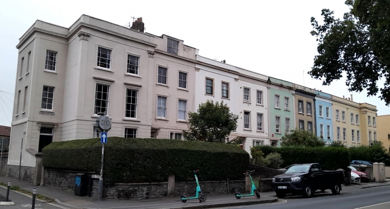
Terrace of 10 houses. c1820. Stucco over rubble walls, pantile roof with brick stacks. Double-depth plan. Each of 3 storeys and basement; 2-window range. A formal late-Georgian arrangement with the end houses articulated forward as pavilions, their entrances set back into external terrace corners. End pavilions have clasping pilasters and acanthus capitals, plain pilasters separating each house and banded rustication on the ground floor. Recessed doors with 2 round-topped moulded panels and floating cornices above on consoles; tripartite ground floors with shouldered architraves, the few surviving original windows are 6/6-pane sashes with margin bars. End elevations with 1:2-window range, blind to end of terrace. INTERIOR not inspected, but noted as having shutters to first floors. Attributed to H Rumley, 1851 by (Gomme), but shown on Ashmead's Map of Bristol of 1821. (Ashmead: Ashmead's Map of Bristol: Bristol: 1821-; Gomme A, Jenner M and Little B: Bristol, An Architectural History: Bristol: 1979-).
Listing NGR: ST5838672003
External links are from the relevant listing authority and, where applicable, Wikidata. Wikidata IDs may be related buildings as well as this specific building. If you want to add or update a link, you will need to do so by editing the Wikidata entry.


Other nearby listed buildings