Latitude: 51.4472 / 51°26'49"N
Longitude: -2.6005 / 2°36'1"W
OS Eastings: 358362
OS Northings: 172191
OS Grid: ST583721
Mapcode National: GBR C6N.V2
Mapcode Global: VH88M.WW2G
Plus Code: 9C3VC9WX+VQ
Entry Name: Prince's Wharf and Wapping Wharf, quays and bollards
Listing Date: 30 December 1994
Grade: II
Source: Historic England
Source ID: 1279514
English Heritage Legacy ID: 379484
ID on this website: 101279514
Location: Canon's Marsh, Bristol, BS1
County: City of Bristol
Electoral Ward/Division: Hotwells and Harbourside
Parish: Non Civil Parish
Built-Up Area: Bristol
Traditional County: Somerset
Lieutenancy Area (Ceremonial County): Bristol
Church of England Parish: St Mary Redcliffe with Temple, Bristol and St John the Baptist, Bedminster
Church of England Diocese: Bristol
Tagged with: Wharf
This list entry was subject to a Minor Amendment on 13 June 2025 to amend the description and to reformat the text to current standards
ST5872
901-1/42/1297
BRISTOL
CUMBERLAND ROAD (north side)
Floating Harbour
Prince's Wharf and Wapping Wharf, quays and bollards
GV
II
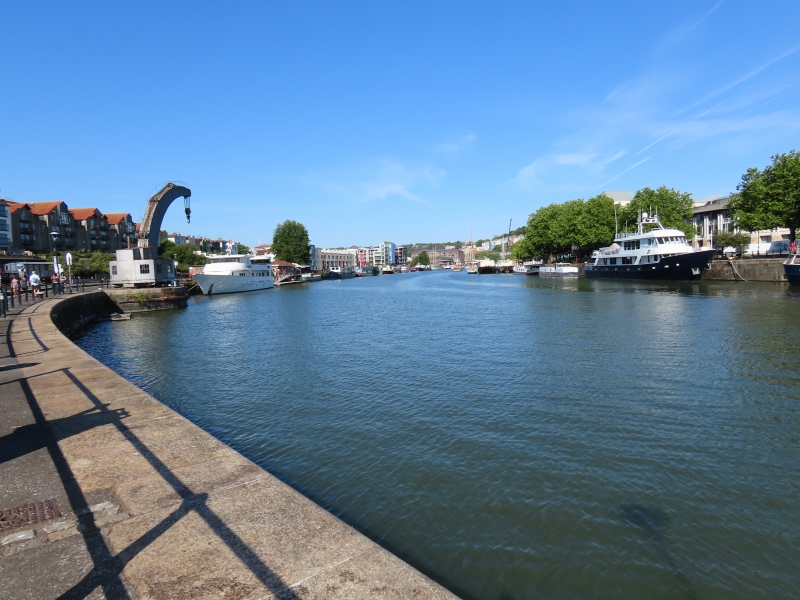
Quays and bollards. 1874-76. By Thomas Howard, Docks Engineer. Granite and Pennant with cast-iron bollards. Granite curbs to Pennant rubble walls. Quay walls built 'chiefly of concrete, partly of the best hydraulic lime and partly of Portland Cement faced with stonework and granite' (Lord). Projecting bay and the Fairbairn Crane listed separately at Grade II*, NHLE ?1202666. (Lord J and Southam J: The Floating Harbour: Bristol: 1983-: 52).
Listing NGR: ST5836272191
This list entry was subject to a Minor Amendment on 13 June 2025 to amend the description and to reformat the text to current standards
ST5872
901-1/42/1297
BRISTOL
CUMBERLAND ROAD (north side)
Floating Harbour
Prince's Wharf and Wapping Wharf, quays and bollards
GV
II
Quays and bollards. 1874-76. By Thomas Howard, Docks Engineer. Granite and Pennant with cast-iron bollards. Granite curbs to Pennant rubble walls. Quay walls built 'chiefly of concrete, partly of the best hydraulic lime and partly of Portland Cement faced with stonework and granite' (Lord). Projecting bay and the Fairbairn Crane listed separately at Grade II*, NHLE ?1202666. (Lord J and Southam J: The Floating Harbour: Bristol: 1983-: 52).
Listing NGR: ST5836272191
External links are from the relevant listing authority and, where applicable, Wikidata. Wikidata IDs may be related buildings as well as this specific building. If you want to add or update a link, you will need to do so by editing the Wikidata entry.


Other nearby listed buildings