Latitude: 51.294 / 51°17'38"N
Longitude: 0.4081 / 0°24'29"E
OS Eastings: 567997
OS Northings: 157742
OS Grid: TQ679577
Mapcode National: GBR NPC.VBH
Mapcode Global: VHJM5.1Q3W
Plus Code: 9F327CV5+J7
Entry Name: Arundel House
Listing Date: 1 August 1952
Grade: II
Source: Historic England
Source ID: 1209091
English Heritage Legacy ID: 392358
ID on this website: 101209091
Location: West Malling, Tonbridge and Malling, Kent, ME19
County: Kent
District: Tonbridge and Malling
Civil Parish: West Malling
Built-Up Area: West Malling
Traditional County: Kent
Lieutenancy Area (Ceremonial County): Kent
Church of England Parish: West Malling St Mary
Church of England Diocese: Rochester
Tagged with: House
WEST MALLING
TQ6757 HIGH STREET 1156-0/2/50 No.88 01/08/52 Arundel House
GV II
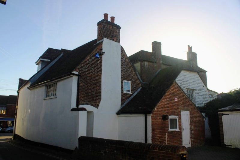
House. C18 or earlier. Front brown stock brick with red brick dressings with stone plinth and collar, right side elevation tile hung and rear elevation clad in weatherboarding. 3 storeys and basement 5 windows. Double wooden coved eaves cornice. Brick plat band to 2nd floor and stuccoed plat band to 1st floor. Plinth. 2nd floor has 2 blanks. Windows are 12-pane sashes in moulded wooden architraves. 2 cambered arches to cellar. Central doorcase with flat cornice on scroll brackets with unusual drop below. Moulded wooden architrave with fluted entablature, rectangular fanlight and 6-fielded panelled door, 2 iron foot scrapers. Original cast-iron support for missing sign attached above 1st floor central window. Rear elevation has 1 fixed 16-pane sash. (Buildings of England: Newman J: West Kent and the Weald: 578).
Listing NGR: TQ6799757742
External links are from the relevant listing authority and, where applicable, Wikidata. Wikidata IDs may be related buildings as well as this specific building. If you want to add or update a link, you will need to do so by editing the Wikidata entry.


Other nearby listed buildings