Approximate Location Map
Large Map »
Latitude: 51.2944 / 51°17'39"N
Longitude: 0.4078 / 0°24'28"E
OS Eastings: 567974
OS Northings: 157784
OS Grid: TQ679577
Mapcode National: GBR NPC.V7S
Mapcode Global: VHJM5.0QYK
Plus Code: 9F327CV5+Q4
Entry Name: Outbuilding to Rear of No 16
Listing Date: 30 November 1993
Grade: II
Source: Historic England
Source ID: 1209137
English Heritage Legacy ID: 392487
ID on this website: 101209137
Location: West Malling, Tonbridge and Malling, Kent, ME19
County: Kent
District: Tonbridge and Malling
Civil Parish: West Malling
Built-Up Area: West Malling
Traditional County: Kent
Lieutenancy Area (Ceremonial County): Kent
Church of England Parish: West Malling St Mary
Church of England Diocese: Rochester
Tagged with: Appendage
WEST MALLING
TQ6757 WEST STREET
1156-0/2/174 (East side)
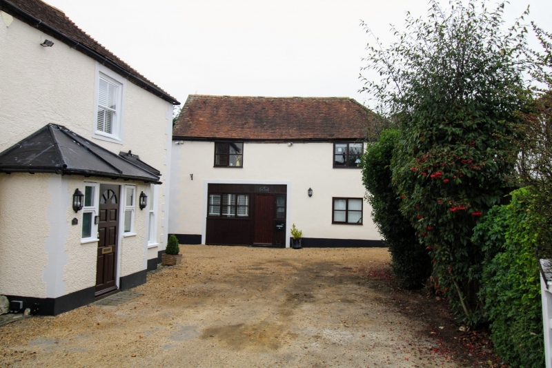
Outbuilding to rear of No 16
GV II
Probably former stable and coach house. Late C18 or early C19.
Front now pebbledashed, rest red brick with grey headers in
Flemish bond with tiled roof hipped to right. 2 glazed windows
and modern garage doors.
Listing NGR: TQ6797457784
External links are from the relevant listing authority and, where applicable, Wikidata. Wikidata IDs may be related buildings as well as this specific building. If you want to add or update a link, you will need to do so by editing the Wikidata entry.


Other nearby listed buildings
