Approximate Location Map
Large Map »
Latitude: 52.3386 / 52°20'18"N
Longitude: -2.2819 / 2°16'55"W
OS Eastings: 380886
OS Northings: 271203
OS Grid: SO808712
Mapcode National: GBR 0BZ.CW8
Mapcode Global: VH920.DHH3
Plus Code: 9C4V8PQ9+C6
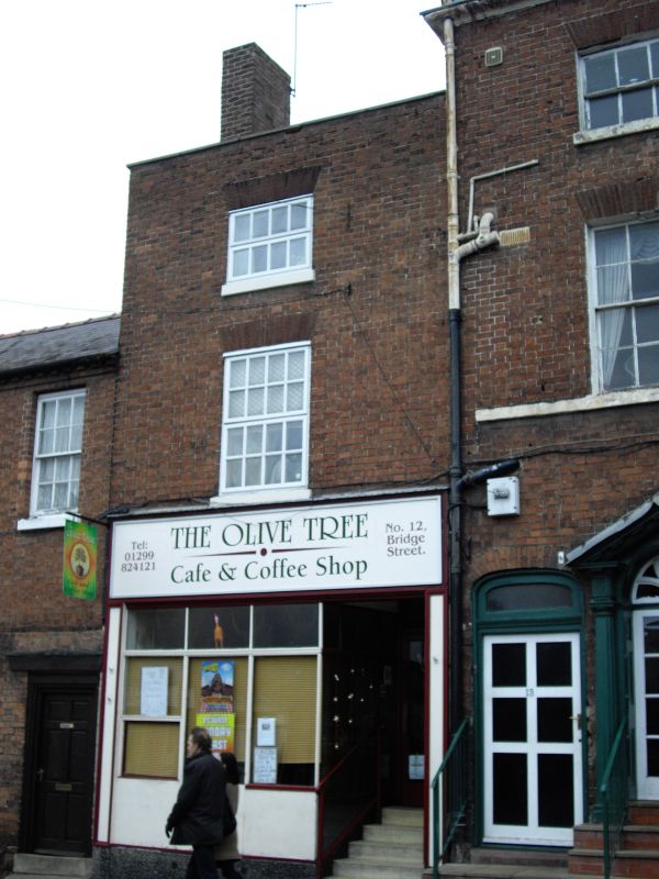
Entry Name: 12, Bridge Street
Listing Date: 11 October 1991
Grade: II
Source: Historic England
Source ID: 1209448
English Heritage Legacy ID: 393309
ID on this website: 101209448
Location: Stourport-on-Severn, Wyre Forest, Worcestershire, DY13
County: Worcestershire
District: Wyre Forest
Civil Parish: Stourport-on-Severn
Built-Up Area: Stourport-on-Severn
Traditional County: Worcestershire
Lieutenancy Area (Ceremonial County): Worcestershire
Church of England Parish: Stourport-on-Severn and Wilden
Church of England Diocese: Worcester
Tagged with: Building
STOURPORT ON SEVERN
SO8071SE BRIDGE STREET
589-1/8/3 (North West side)
No.12
GV II
Shop, possibly purpose-built. Late C18. Brick with renewed
concrete tiled roof. Single bay, 3-storeyed, with renewed shop
front and 12-pane sash windows (8-panes to attic storey) with
gauged brick heads above. Parapet eaves, single gable end
stack. Included for group value.
Listing NGR: SO8088671203
External links are from the relevant listing authority and, where applicable, Wikidata. Wikidata IDs may be related buildings as well as this specific building. If you want to add or update a link, you will need to do so by editing the Wikidata entry.


Other nearby listed buildings
