Approximate Location Map
Large Map »
Latitude: 52.3386 / 52°20'18"N
Longitude: -2.2819 / 2°16'54"W
OS Eastings: 380889
OS Northings: 271206
OS Grid: SO808712
Mapcode National: GBR 0BZ.CXC
Mapcode Global: VH920.DHH2
Plus Code: 9C4V8PQ9+C6
Entry Name: 13, Bridge Street
Listing Date: 5 July 1950
Grade: II
Source: Historic England
Source ID: 1292637
English Heritage Legacy ID: 393310
ID on this website: 101292637
Location: Stourport-on-Severn, Wyre Forest, Worcestershire, DY13
County: Worcestershire
District: Wyre Forest
Civil Parish: Stourport-on-Severn
Built-Up Area: Stourport-on-Severn
Traditional County: Worcestershire
Lieutenancy Area (Ceremonial County): Worcestershire
Church of England Parish: Stourport-on-Severn and Wilden
Church of England Diocese: Worcester
Tagged with: Building
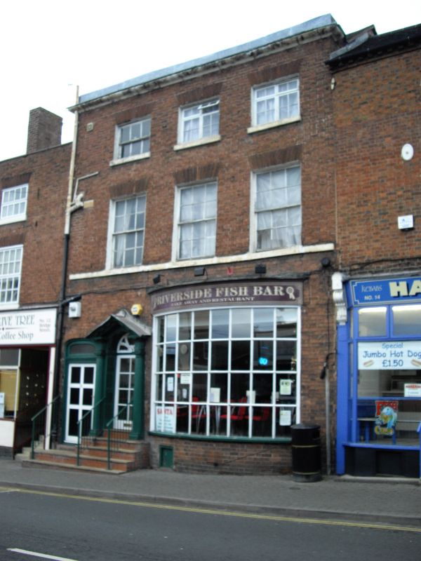
STOURPORT ON SEVERN
SO8071SE BRIDGE STREET
589-1/8/4 (North West side)
05/07/50 No.13
GV II
Shop, possibly purpose-built. Late C18. Brick with plain tiled
roof. 3- storeyed, 3 bays, with central door in steep pediment
with fluted shafts and panelled rebates, and arched entry to
passage way to left. Inserted shop windows, but sashes above
have fine gauged brick heads. Sill band below first floor
windows. Stuccoed parapet to eaves.
Listing NGR: SO8088971206
External links are from the relevant listing authority and, where applicable, Wikidata. Wikidata IDs may be related buildings as well as this specific building. If you want to add or update a link, you will need to do so by editing the Wikidata entry.


Other nearby listed buildings
