Latitude: 54.1625 / 54°9'44"N
Longitude: -3.1876 / 3°11'15"W
OS Eastings: 322552
OS Northings: 474728
OS Grid: SD225747
Mapcode National: GBR 6N59.PM
Mapcode Global: WH72B.0MCT
Plus Code: 9C6R5R66+XX
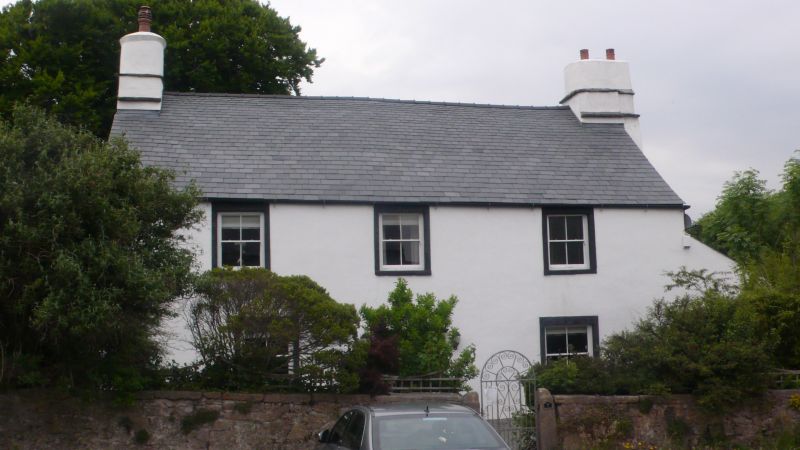
Entry Name: Elliscale Farmhouse
Listing Date: 6 May 1976
Grade: II
Source: Historic England
Source ID: 1209542
English Heritage Legacy ID: 388395
ID on this website: 101209542
Location: Dalton-in-Furness, Westmorland and Furness, Cumbria, LA15
County: Westmorland and Furness
District: Barrow-in-Furness
Civil Parish: Dalton Town with Newton
Traditional County: Lancashire
Lieutenancy Area (Ceremonial County): Cumbria
Church of England Parish: Dalton-in-Furness St Mary
Church of England Diocese: Carlisle
Tagged with: Farmhouse
BARROW IN FURNESS
SD2274 ASKAM ROAD, Dalton In Furness 708-1/10/153 (East side) 06/05/76 Elliscale Farmhouse
GV II
Farmhouse. C17 altered early C19. Scored stucco over stone, graduated slate roof. 2 storeys and attic, 3 windows to 1st floor; wing to rear right and 3-storey stair projection; lean-to against right return. Conservatory covers central doorway having 5-panel, part-glazed door in ashlar surround with cornice on consoles. Flanking windows and those to 1st floor have 4-pane sashes with projecting stone sills and raised surrounds. Steeply-pitched roof with ashar gable copings on left. Large external stack to right has tabling and rounded shaft; similar end stack on left. INTERIOR: C19 wooden spiral staircase with tapered octagonal newel; steep stone staircase into rear wing. Attic has oak floor boards and 3 principal-rafter trusses with curved collars: one truss infilled with studwork, another has iron grinder attached; date 1819 in slate torching.
Listing NGR: SD2255274728
External links are from the relevant listing authority and, where applicable, Wikidata. Wikidata IDs may be related buildings as well as this specific building. If you want to add or update a link, you will need to do so by editing the Wikidata entry.


Other nearby listed buildings