Approximate Location Map
Large Map »
Latitude: 52.3371 / 52°20'13"N
Longitude: -2.2832 / 2°16'59"W
OS Eastings: 380798
OS Northings: 271039
OS Grid: SO807710
Mapcode National: GBR 0BZ.KJT
Mapcode Global: VH920.CJT7
Plus Code: 9C4V8PP8+RP
Entry Name: Bridge over River Severn
Listing Date: 9 November 1971
Grade: II
Source: Historic England
Source ID: 1209919
English Heritage Legacy ID: 393314
ID on this website: 101209919
Location: Stourport-on-Severn, Wyre Forest, Worcestershire, DY13
County: Worcestershire
District: Wyre Forest
Civil Parish: Stourport-on-Severn
Built-Up Area: Stourport-on-Severn
Traditional County: Worcestershire
Lieutenancy Area (Ceremonial County): Worcestershire
Church of England Parish: Stourport-on-Severn and Wilden
Church of England Diocese: Worcester
Tagged with: Bridge Road bridge
STOURPORT ON SEVERN
SO8071SE BRIDGE STREET
589-1/8/8 Bridge over River Severn
09/11/71
GV II
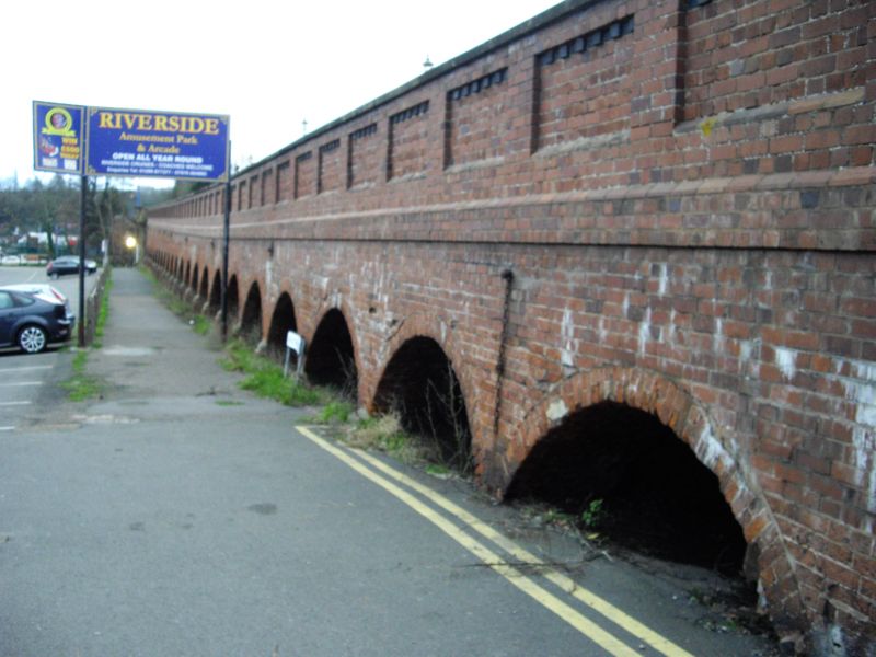
Bridge over River Severn. Largely 1870, but parts of earlier
structures remain. Main arch is cast-iron, flanked by stone
faced brick arches and a causeway of 25 brick arches to north,
6 to south. Lower section of causeway on NE side is late C18
brick, with stone springers to the arches. Early C20 panelled
brick parapet above, in imitation of C19 parapet which remains
to NW. 3 stone faced arches incoporate iron gates giving
access to spiral cast iron stairways to river banks on west
side. Iron arch has gentle curve with interlaced circles to
parapet and traceried circles in the spandrels. Shield with
date and initials S.T.B. on spandrels at each side. Bridge is
the third on this site, the first, of 1775, thought to have
been designed by Thomas Farnolls Pritchard. Brick with an iron
centre, it was destroyed in 1795 and replaced in 1806. Remains
of both these earlier bridges seem to be incorporated in the
present causeway construction.
Listing NGR: SO8079871039
External links are from the relevant listing authority and, where applicable, Wikidata. Wikidata IDs may be related buildings as well as this specific building. If you want to add or update a link, you will need to do so by editing the Wikidata entry.


Other nearby listed buildings
