Approximate Location Map
Large Map »
Latitude: 50.3383 / 50°20'17"N
Longitude: -4.7918 / 4°47'30"W
OS Eastings: 201432
OS Northings: 52434
OS Grid: SX014524
Mapcode National: GBR ZX.9YDZ
Mapcode Global: FRA 08V4.P07
Plus Code: 9C2Q86Q5+87
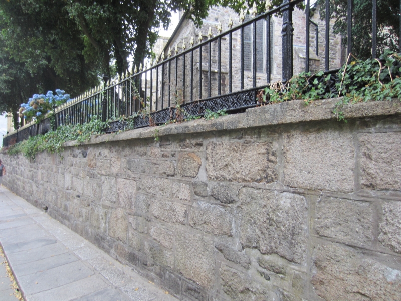
Entry Name: Churchyard Wall and Railings
Listing Date: 11 March 1974
Grade: II
Source: Historic England
Source ID: 1211927
English Heritage Legacy ID: 396361
ID on this website: 101211927
Location: St Austell, Cornwall, PL25
County: Cornwall
Civil Parish: St Austell
Built-Up Area: St Austell
Traditional County: Cornwall
Lieutenancy Area (Ceremonial County): Cornwall
Church of England Parish: St Austell
Church of England Diocese: Truro
Tagged with: Churchyard wall
ST AUSTELL
1.
1584A
Churchyard Wall and
Railings
SX 0152 1/458
II
2.
Mid to late C19 wall of uncoursed granite blocks. Plain coping, surmounted
by cast iron railings with arrow headed shafts and shaped stanchions.
Listing NGR: SX0144052434
External links are from the relevant listing authority and, where applicable, Wikidata. Wikidata IDs may be related buildings as well as this specific building. If you want to add or update a link, you will need to do so by editing the Wikidata entry.


Other nearby listed buildings
