Approximate Location Map
Large Map »
Latitude: 52.9192 / 52°55'8"N
Longitude: -1.4094 / 1°24'33"W
OS Eastings: 439809
OS Northings: 335912
OS Grid: SK398359
Mapcode National: GBR 6DY.Y8X
Mapcode Global: WHDGV.BW3G
Plus Code: 9C4WWH9R+M7
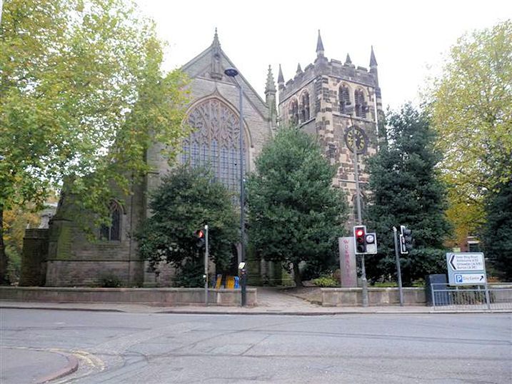
Entry Name: Church of St Werburgh
Listing Date: 10 November 1967
Grade: II
Source: Historic England
Source ID: 1216070
English Heritage Legacy ID: 401329
ID on this website: 101216070
Location: St Werburgh's Church, Spondon, Derby, Derbyshire, DE21
County: City of Derby
Electoral Ward/Division: Spondon
Parish: Non Civil Parish
Built-Up Area: Derby
Traditional County: Derbyshire
Lieutenancy Area (Ceremonial County): Derbyshire
Church of England Parish: Spondon St Werburgh
Church of England Diocese: Derby
Tagged with: Church building
This list entry was subject to a Minor Amendment on 09/07/2012
893/9/60
10-NOV-67
CHURCH STREET
SPONDON
CHURCH OF ST WERBURGH
II
Large medieval parish church consisting of naves and aisles, chancel and west tower. Largely C14 but heavily restored and partly modern. C14 tower and spire. Sedilia, piscina and Easter sepulchre.
External links are from the relevant listing authority and, where applicable, Wikidata. Wikidata IDs may be related buildings as well as this specific building. If you want to add or update a link, you will need to do so by editing the Wikidata entry.


Other nearby listed buildings
