Latitude: 52.9206 / 52°55'14"N
Longitude: -1.4106 / 1°24'38"W
OS Eastings: 439724
OS Northings: 336072
OS Grid: SK397360
Mapcode National: GBR 6DY.XWR
Mapcode Global: WHDGV.9VJC
Plus Code: 9C4WWHCQ+6Q
Entry Name: 25, Park Road
Listing Date: 24 February 1977
Grade: II
Source: Historic England
Source ID: 1228776
English Heritage Legacy ID: 403478
ID on this website: 101228776
Location: Spondon, Derby, Derbyshire, DE21
County: City of Derby
Electoral Ward/Division: Spondon
Parish: Non Civil Parish
Built-Up Area: Derby
Traditional County: Derbyshire
Lieutenancy Area (Ceremonial County): Derbyshire
Church of England Parish: Spondon St Werburgh
Church of England Diocese: Derby
Tagged with: Building
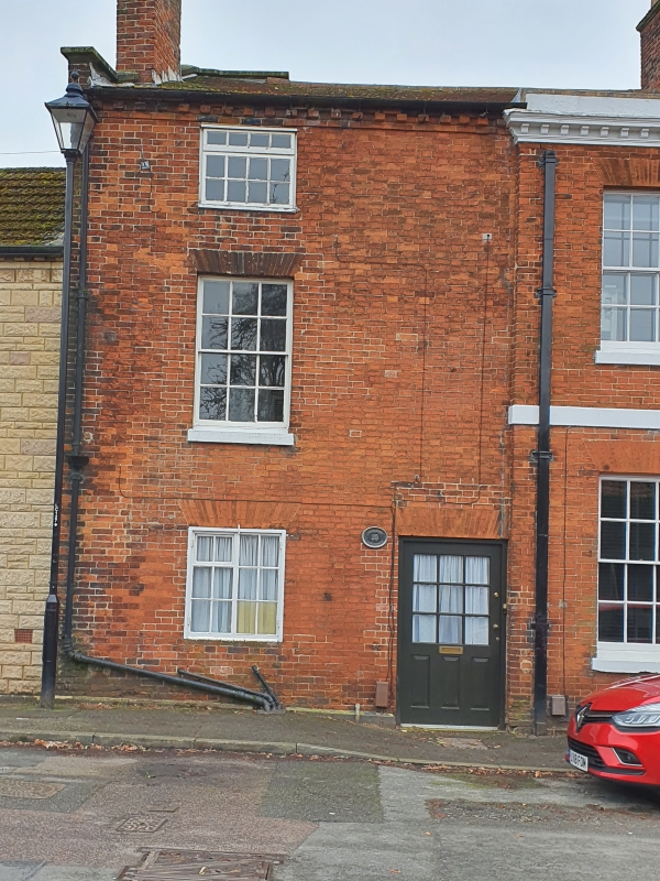
PARK ROAD
1.
5170
(South Side)
Spondon
No 25
SK 33 NE 9/218
II
2.
Late C18. Narrow-fronted plain house of red brick. 3 storeys; one sash window;
plain doorway on right-hand side with flush-panelled door; modillion eaves; tiles.
Listing NGR: SK3972136072
External links are from the relevant listing authority and, where applicable, Wikidata. Wikidata IDs may be related buildings as well as this specific building. If you want to add or update a link, you will need to do so by editing the Wikidata entry.


Other nearby listed buildings