Approximate Location Map
Large Map »
Latitude: 52.9205 / 52°55'13"N
Longitude: -1.4102 / 1°24'36"W
OS Eastings: 439751
OS Northings: 336060
OS Grid: SK397360
Mapcode National: GBR 6DY.Y0P
Mapcode Global: WHDGV.9VQG
Plus Code: 9C4WWHCQ+5W
Entry Name: The Grange
Listing Date: 24 February 1977
Grade: II
Source: Historic England
Source ID: 1228894
English Heritage Legacy ID: 403477
ID on this website: 101228894
Location: Spondon, Derby, Derbyshire, DE21
County: City of Derby
Electoral Ward/Division: Spondon
Parish: Non Civil Parish
Built-Up Area: Derby
Traditional County: Derbyshire
Lieutenancy Area (Ceremonial County): Derbyshire
Church of England Parish: Spondon St Werburgh
Church of England Diocese: Derby
Tagged with: Building
PARK ROAD
1.
5170
(South Side)
Spondon
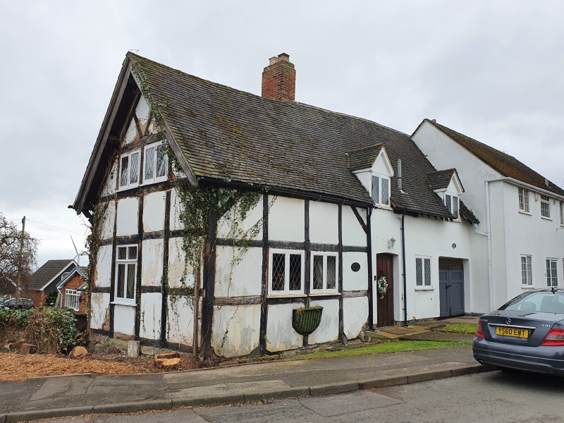
The Grange
SK 33 NE 9/217
II
2.
C16. Much altered and restored. Timber-framed with square panels, black and white;
one storey and attic; modern leaded casement windows; plain doorway with cambered
head and facsimile oak door; old tiles.
Listing NGR: SK3975136060
External links are from the relevant listing authority and, where applicable, Wikidata. Wikidata IDs may be related buildings as well as this specific building. If you want to add or update a link, you will need to do so by editing the Wikidata entry.


Other nearby listed buildings
