Latitude: 53.3899 / 53°23'23"N
Longitude: -2.9397 / 2°56'23"W
OS Eastings: 337599
OS Northings: 388534
OS Grid: SJ375885
Mapcode National: GBR 7GV.2S
Mapcode Global: WH87F.T290
Plus Code: 9C5V93Q6+X4
Entry Name: Saint Agnes' Vicarage
Listing Date: 28 June 1952
Grade: II*
Source: Historic England
Source ID: 1218225
English Heritage Legacy ID: 359627
ID on this website: 101218225
Location: Liverpool, Merseyside, L17
County: Liverpool
Electoral Ward/Division: Greenbank
Parish: Non Civil Parish
Built-Up Area: Liverpool
Traditional County: Lancashire
Lieutenancy Area (Ceremonial County): Merseyside
Church of England Parish: Toxteth Park St Agnes and St Pancras
Church of England Diocese: Liverpool
Tagged with: Clergy house
This list entry was subject to a Minor Amendment on 11 March 2026 to amend the name and address and reformat the text to current standards
SJ 3788
33/1247
BUCKINGHAM AVENUE
No 1, St Agnes and St Pancras’ Vicarage
(Formerly listed as Saint Agnes' Vicarage, ULLET ROAD L17)
28.6.52
G.V.
II*
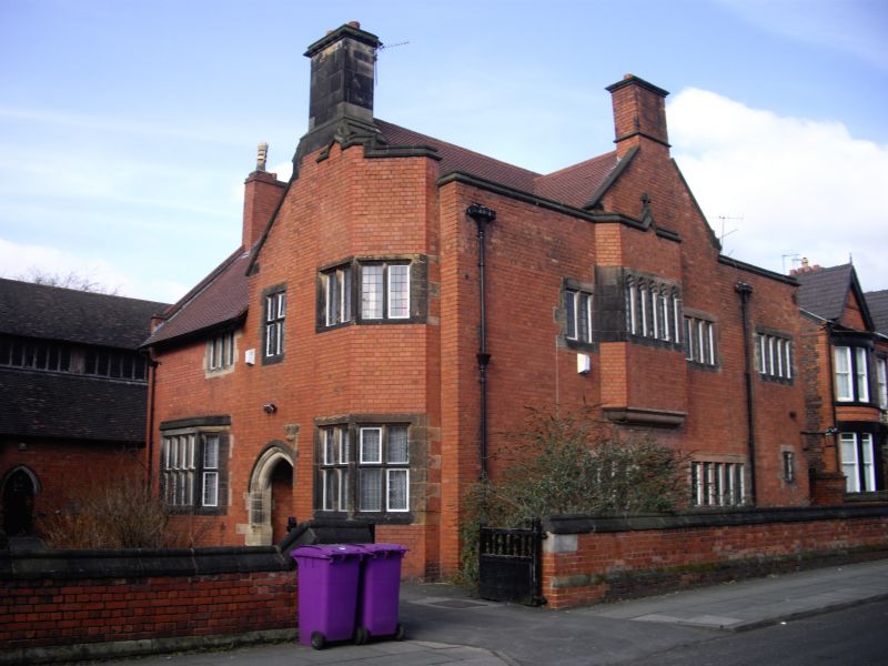
Vicarage to rear of church. 1887. Norman Shaw. Red brick with stone dressings, tile roof. Two storeys, 3 x 3 bays. Irregular plan, casement windows with stone mullions and transoms, of varying sizes. Entrance flanked by canted bay windows, that to right of two storeys with shaped parapet. Right return to Buckingham Avenue has canted oriel with window of five cusped lights and cross over. Recessed entrance with pointed arch and hood. Gable with stone to front stack; two brick end stacks.
Listing NGR: SJ3760288532
External links are from the relevant listing authority and, where applicable, Wikidata. Wikidata IDs may be related buildings as well as this specific building. If you want to add or update a link, you will need to do so by editing the Wikidata entry.


Other nearby listed buildings