Latitude: 53.266 / 53°15'57"N
Longitude: -2.1433 / 2°8'35"W
OS Eastings: 390540
OS Northings: 374342
OS Grid: SJ905743
Mapcode National: GBR FZGN.SY
Mapcode Global: WHBBP.15NK
Plus Code: 9C5V7V84+9M
Entry Name: Mount Pleasant
Listing Date: 28 October 1994
Grade: II
Source: Historic England
Source ID: 1221088
English Heritage Legacy ID: 391086
ID on this website: 101221088
Location: Cheshire East, Cheshire, SK10
County: Cheshire East
Civil Parish: Macclesfield
Built-Up Area: Macclesfield
Traditional County: Cheshire
Lieutenancy Area (Ceremonial County): Cheshire
Church of England Parish: Upton Priory Church of the Resurrection
Church of England Diocese: Chester
Tagged with: Architectural structure
MACCLESFIELD
SJ97SW PRESTBURY ROAD 886-1/4/181 Mount Pleasant
II
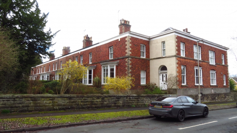
Terrace of 8 houses, one now divided as flats. c1850. Brick with stone dressings and Welsh slate roofs. 2 storeys and basement, 14-window range with recessed outer bays. Regularly planned with paired doorways to central 6 houses, single outer doorways to outer houses. Each a single room, deep pile plan. All have round-arched doorways with 4-panelled doors with glazed round-arched upper panels. Architrave carried on console brackets. Lower windows are canted bays with casement windows divided by pilasters carrying moulded cornice. Stone sill bands to 1st-floor 4-pane sash windows with flat-arched gauged brick heads. Axial stacks with yellow brick quoins. Stone plinth, yellow brick angle quoins. A remarkably intact example of its date.
Listing NGR: SJ9054074342
External links are from the relevant listing authority and, where applicable, Wikidata. Wikidata IDs may be related buildings as well as this specific building. If you want to add or update a link, you will need to do so by editing the Wikidata entry.


Other nearby listed buildings