Latitude: 51.8099 / 51°48'35"N
Longitude: -1.6358 / 1°38'8"W
OS Eastings: 425204
OS Northings: 212424
OS Grid: SP252124
Mapcode National: GBR 5SW.F87
Mapcode Global: VHBZS.LRKX
Plus Code: 9C3WR957+XM
Entry Name: 15 and 17, High Street
Listing Date: 12 September 1955
Last Amended: 1 March 1990
Grade: II
Source: Historic England
Source ID: 1223725
English Heritage Legacy ID: 419551
ID on this website: 101223725
Location: Burford, West Oxfordshire, OX18
County: Oxfordshire
District: West Oxfordshire
Civil Parish: Burford
Built-Up Area: Burford
Traditional County: Oxfordshire
Lieutenancy Area (Ceremonial County): Oxfordshire
Church of England Parish: Burford
Church of England Diocese: Oxford
Tagged with: Building
BURFORD AND UPTON HIGH STREET AND SIGNET (East Side) SP2512 (Enlargement) Nos 15 and 17 7/53 (Previously listed as 12.9.55 two cottages on NW corner of Lawrence Lane)
GV II
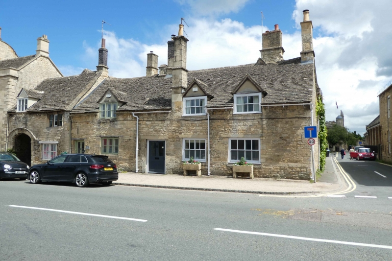
Cottage row. C16 origins, C19 and C20 remodelling. Rubble with Cotswold stone roof. Lobby-entry plan. Single storey and attic, 3 gabled half- dormers with glazing bar sash windows. 3 windows, 2 to right with glazing bar sashes and concreted lintels, to left C20 3-light metal casement with timber lintel. Two doors, No 15, to left, half-glazed, No 17 a C17 or early C18 adapted 4-panel door with concreted lintel. Large truncated central chimney and tall ashlar chimney to right.
Listing NGR: SP2520412424
External links are from the relevant listing authority and, where applicable, Wikidata. Wikidata IDs may be related buildings as well as this specific building. If you want to add or update a link, you will need to do so by editing the Wikidata entry.


Other nearby listed buildings