Latitude: 51.8078 / 51°48'27"N
Longitude: -1.6369 / 1°38'12"W
OS Eastings: 425133
OS Northings: 212187
OS Grid: SP251121
Mapcode National: GBR 5SW.M06
Mapcode Global: VHBZS.LT0J
Plus Code: 9C3WR957+47
Entry Name: Huffkins Premises Adjoining Rose and Crown on the South
Listing Date: 12 September 1955
Grade: II
Source: Historic England
Source ID: 1224530
English Heritage Legacy ID: 420375
Also known as: Huffkins
Premises adjoining Rose and Crown on the south
ID on this website: 101224530
Location: Burford, West Oxfordshire, OX18
County: Oxfordshire
District: West Oxfordshire
Civil Parish: Burford
Built-Up Area: Burford
Traditional County: Oxfordshire
Lieutenancy Area (Ceremonial County): Oxfordshire
Church of England Parish: Burford
Church of England Diocese: Oxford
Tagged with: Architectural structure House Bakery Tea house
BURFORD AND UPTON HIGH STREET AND SIGNET (West Side) SP2512 (Enlargement) No 98 (Huffkins) 7/140 (previously listed as premises 12.9.55 adjoining Rose and Crown on the south)
GV II
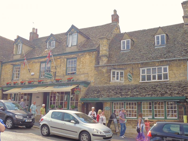
House. C16, altered mid-late C19. Rubble 1st floor, slate roof with brick end chimneys. 2 storeys and attics. 3 gabled dormers, outer ones on wall-face. 3 windows, glazing-bar sashes, inner one paired. Most of the ground-floor is occupied by a tripartite glazing-bar shop window with fluted pilasters of early C20, outer doorways, half-glazed doors with segmental heads. Long 1-and 2-storey L-plan wing to rear. Interior: inside shop a Caernarvon-arch doorway with wave moulding (re-set), chamfered beams with heavy joists and, upstairs, according to Buildings of England, Tudor arch fireplaces. J. Sherwood and N Pevsner: Buildings of of England: Oxford, 1974.
Listing NGR: SP2513312187
External links are from the relevant listing authority and, where applicable, Wikidata. Wikidata IDs may be related buildings as well as this specific building. If you want to add or update a link, you will need to do so by editing the Wikidata entry.


Other nearby listed buildings