Approximate Location Map
Large Map »
Latitude: 51.5486 / 51°32'54"N
Longitude: -0.0504 / 0°3'1"W
OS Eastings: 535275
OS Northings: 185103
OS Grid: TQ352851
Mapcode National: GBR J7.3Z8
Mapcode Global: VHGQV.2BPP
Plus Code: 9C3XGWXX+CR
Entry Name: Gate and Piers to Sutton House
Listing Date: 4 February 1975
Grade: II
Source: Historic England
Source ID: 1226767
English Heritage Legacy ID: 424223
ID on this website: 101226767
Location: Lower Clapton, Hackney, London, E9
County: London
District: Hackney
Electoral Ward/Division: Homerton
Parish: Non Civil Parish
Built-Up Area: Hackney
Traditional County: Middlesex
Lieutenancy Area (Ceremonial County): Greater London
Church of England Parish: St John at Hackney
Church of England Diocese: London
Tagged with: Gate
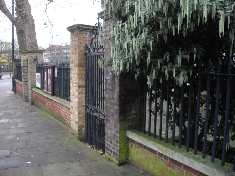
1. HOMERTON HIGH STREET E9
5013
(South Side)
-----------------------
Gate and Piers to
Sutton House
TQ 3585 20/259
II
2.
2 rebuilt square piers, of stock brick with stone coping, hold C18 wrought iron
gate with overthrow.
Listing NGR: TQ3527585103
External links are from the relevant listing authority and, where applicable, Wikidata. Wikidata IDs may be related buildings as well as this specific building. If you want to add or update a link, you will need to do so by editing the Wikidata entry.


Other nearby listed buildings
