Approximate Location Map
Large Map »
Latitude: 50.7318 / 50°43'54"N
Longitude: -2.7583 / 2°45'29"W
OS Eastings: 346581
OS Northings: 92740
OS Grid: SY465927
Mapcode National: GBR PP.0C25
Mapcode Global: FRA 5734.P8M
Plus Code: 9C2VP6JR+PM
Entry Name: 50-54, South Street
Listing Date: 19 September 1975
Grade: II
Source: Historic England
Source ID: 1228326
English Heritage Legacy ID: 402920
ID on this website: 101228326
Location: New Zealand, Dorset, DT6
County: Dorset
Civil Parish: Bridport
Built-Up Area: Bridport
Traditional County: Dorset
Lieutenancy Area (Ceremonial County): Dorset
Church of England Parish: Bridport St Mary
Church of England Diocese: Salisbury
Tagged with: Building
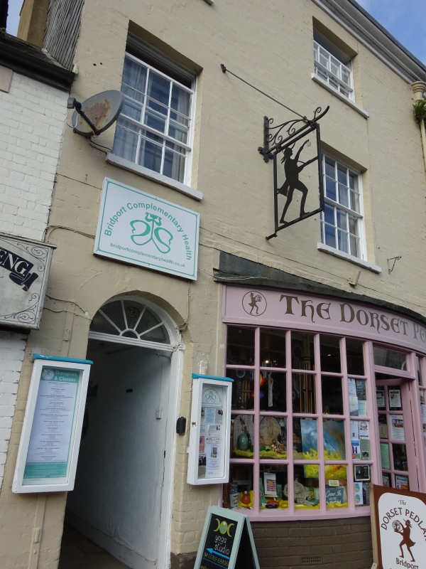
1.
5l91 SOUTH STREET
(West Side)
Nos 50 to 54 (even)
SY 4692 1/99
II CV
2.
Early C19. Brick, 2 colour washed. 3 storeys. 2 ranges of sashes with glazing
bars each. 2 doors with moulded panels and semi-circular fanlights. Inserted
shop fronts. Original rainwater head and down pipe.
Nos 46 to 54 (even) form a group.
Listing NGR: SY4657892749
External links are from the relevant listing authority and, where applicable, Wikidata. Wikidata IDs may be related buildings as well as this specific building. If you want to add or update a link, you will need to do so by editing the Wikidata entry.


Other nearby listed buildings
