Approximate Location Map
Large Map »
Latitude: 50.7316 / 50°43'53"N
Longitude: -2.7578 / 2°45'27"W
OS Eastings: 346615
OS Northings: 92719
OS Grid: SY466927
Mapcode National: GBR PP.0K4F
Mapcode Global: FRA 5734.PG5
Plus Code: 9C2VP6JR+MV
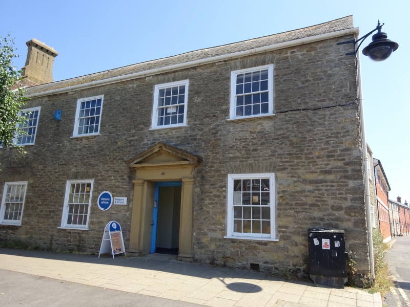
Entry Name: 45, South Street
Listing Date: 19 September 1975
Grade: II
Source: Historic England
Source ID: 1287458
English Heritage Legacy ID: 402345
ID on this website: 101287458
Location: New Zealand, Dorset, DT6
County: Dorset
Civil Parish: Bridport
Built-Up Area: Bridport
Traditional County: Dorset
Lieutenancy Area (Ceremonial County): Dorset
Church of England Parish: Bridport St Mary
Church of England Diocese: Salisbury
Tagged with: Building
1.
5191
SOUTH STREET
(East Side)
----------
No 45
SY 4692 1/119
II
2.
C18. Former net factory. Coursed rubble. Slate roof. 2 storeys. 6 ranges
of sashes with wide frames and gauged stone voussoirs. Doorway with original
6-panelled and neo-Georgian ashlar surround. 3 ranges of sashes with glazing
bars in rear.
Listing NGR: SY4661592719
External links are from the relevant listing authority and, where applicable, Wikidata. Wikidata IDs may be related buildings as well as this specific building. If you want to add or update a link, you will need to do so by editing the Wikidata entry.


Other nearby listed buildings
