Approximate Location Map
Large Map »
Latitude: 53.5401 / 53°32'24"N
Longitude: -2.7045 / 2°42'16"W
OS Eastings: 353409
OS Northings: 405058
OS Grid: SD534050
Mapcode National: GBR 9WKH.8P
Mapcode Global: WH86S.F8CY
Plus Code: 9C5VG7RW+26
Entry Name: Orrell Post Outside the Stag Inn
Listing Date: 30 March 1966
Grade: II
Source: Historic England
Source ID: 1228432
English Heritage Legacy ID: 403040
ID on this website: 101228432
Location: Orrell, Wigan, Greater Manchester, WN5
County: Wigan
Electoral Ward/Division: Orrell
Parish: Non Civil Parish
Built-Up Area: Wigan
Traditional County: Lancashire
Lieutenancy Area (Ceremonial County): Greater Manchester
Church of England Parish: Orrell St Luke
Church of England Diocese: Liverpool
Tagged with: Architectural structure Roadside stone Pillar Tuscan order
SD 50 NW
4/103
30.3.66
ORRELL
ORRELL ROAD
(north side)
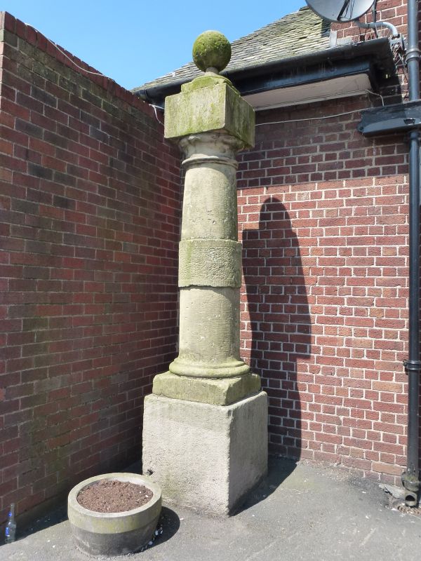
Orrell post outside the Stag Inn
II
Post C17 or C18. Plain square plinth and Tuscan column with
entasis and rusticated band. Top square cap with ball
finial. A post on this site recorded in existence in 1607.
Listing NGR: SD5340905058
External links are from the relevant listing authority and, where applicable, Wikidata. Wikidata IDs may be related buildings as well as this specific building. If you want to add or update a link, you will need to do so by editing the Wikidata entry.


Other nearby listed buildings
