Latitude: 52.9275 / 52°55'38"N
Longitude: -1.4811 / 1°28'51"W
OS Eastings: 434982
OS Northings: 336802
OS Grid: SK349368
Mapcode National: GBR PJC.FX
Mapcode Global: WHDGT.6PZ2
Plus Code: 9C4WWGG9+XH
Entry Name: Seven Stars Inn
Listing Date: 20 June 1952
Grade: II
Source: Historic England
Source ID: 1228456
English Heritage Legacy ID: 402861
ID on this website: 101228456
Location: Derby, Derbyshire, DE1
County: City of Derby
Electoral Ward/Division: Darley
Parish: Non Civil Parish
Built-Up Area: Derby
Traditional County: Derbyshire
Lieutenancy Area (Ceremonial County): Derbyshire
Church of England Parish: Derby St Alkmund and St Werburgh
Church of England Diocese: Derby
Tagged with: Inn
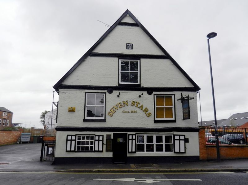
KING STREET
1.
5170
No 97
(Seven Stars Inn)
SK 3536 NW 3/167 20.6.52.
II
2.
Late C17. Painted brick. Large gable end to street, divided by 4 bands of moulded
brick; 2 C19 windows and 2 small low ground storey windows flanking C19 plain doorway;
2 storeys and attic in gable; modern tiles. Date-stone 1680.
Listing NGR: SK3497736801
External links are from the relevant listing authority and, where applicable, Wikidata. Wikidata IDs may be related buildings as well as this specific building. If you want to add or update a link, you will need to do so by editing the Wikidata entry.


Other nearby listed buildings