Approximate Location Map
Large Map »
Latitude: 50.7336 / 50°44'0"N
Longitude: -2.7591 / 2°45'32"W
OS Eastings: 346521
OS Northings: 92935
OS Grid: SY465929
Mapcode National: GBR PP.0BSK
Mapcode Global: FRA 5734.NWL
Plus Code: 9C2VP6MR+C8
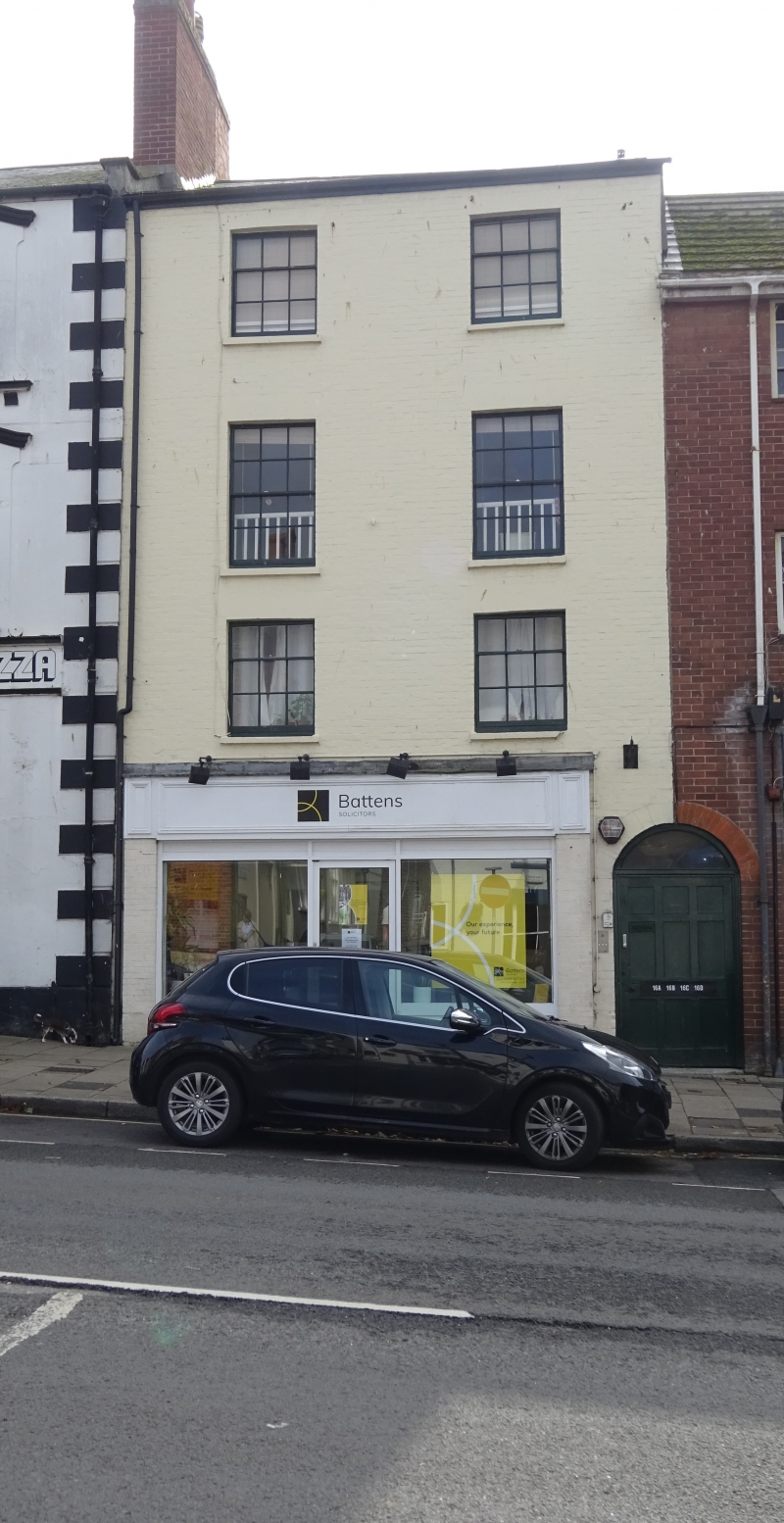
Entry Name: 16, West Street
Listing Date: 19 September 1975
Grade: II
Source: Historic England
Source ID: 1229096
English Heritage Legacy ID: 403834
ID on this website: 101229096
Location: Bridport, Dorset, DT6
County: Dorset
Civil Parish: Bridport
Built-Up Area: Bridport
Traditional County: Dorset
Lieutenancy Area (Ceremonial County): Dorset
Church of England Parish: Bridport St Mary
Church of England Diocese: Salisbury
Tagged with: Building
1.
5l91 WEST STREET
(South Side)
No 16
SY 4692 1/157
II GV
2.
Early C19. Colour washed brick. 3 storeys. 2 windows. Ground floor has
shop and round headed entry.
Nos 2 to 16 (even) form a group.
Listing NGR: SY4652192935
External links are from the relevant listing authority and, where applicable, Wikidata. Wikidata IDs may be related buildings as well as this specific building. If you want to add or update a link, you will need to do so by editing the Wikidata entry.


Other nearby listed buildings
