Approximate Location Map
Large Map »
Latitude: 50.7336 / 50°44'0"N
Longitude: -2.7591 / 2°45'32"W
OS Eastings: 346527
OS Northings: 92934
OS Grid: SY465929
Mapcode National: GBR PP.0BTN
Mapcode Global: FRA 5734.NXP
Plus Code: 9C2VP6MR+C9
Entry Name: The Star Hotel
Listing Date: 19 September 1975
Grade: II
Source: Historic England
Source ID: 1229066
English Heritage Legacy ID: 403833
ID on this website: 101229066
Location: Bridport, Dorset, DT6
County: Dorset
Civil Parish: Bridport
Built-Up Area: Bridport
Traditional County: Dorset
Lieutenancy Area (Ceremonial County): Dorset
Church of England Parish: Bridport St Mary
Church of England Diocese: Salisbury
Tagged with: Hotel
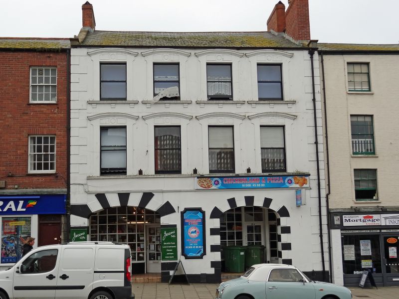
1.
5191 WEST STREET
(South Side)
No 14 (The Star Hotel)
SY 4692 1/156
II GV
2.
C18, altered in C19, stucco. 3 storeys. Rusticated quoins. 4 ranges of
sashes in architraves with scroll sides and segmental heads. 2 ground floor
openings with rusticated surrounds and 3-centred heads.
Nos 2 to 16 (even) form a group.
Listing NGR: SY4652792934
External links are from the relevant listing authority and, where applicable, Wikidata. Wikidata IDs may be related buildings as well as this specific building. If you want to add or update a link, you will need to do so by editing the Wikidata entry.


Other nearby listed buildings
