Latitude: 50.7335 / 50°44'0"N
Longitude: -2.7588 / 2°45'31"W
OS Eastings: 346544
OS Northings: 92933
OS Grid: SY465929
Mapcode National: GBR PP.0BVR
Mapcode Global: FRA 5734.P18
Plus Code: 9C2VP6MR+CF
Entry Name: 10, West Street
Listing Date: 19 September 1975
Grade: II
Source: Historic England
Source ID: 1229065
English Heritage Legacy ID: 403831
ID on this website: 101229065
Location: Bridport, Dorset, DT6
County: Dorset
Civil Parish: Bridport
Built-Up Area: Bridport
Traditional County: Dorset
Lieutenancy Area (Ceremonial County): Dorset
Church of England Parish: Bridport St Mary
Church of England Diocese: Salisbury
Tagged with: Building
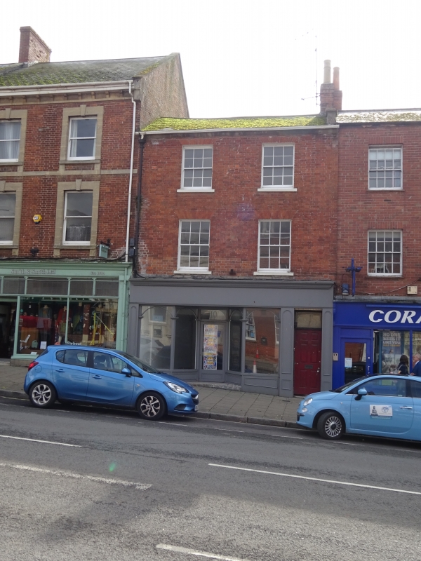
1.
5l91 WEST STREET
(South Side)
No 10
SY 4692 1/155
II GV
2.
Early C19. Red brick. 3 storeys. 2 ranges of sashes with glazing bars.
Glazed tile shopfront of characteristic Art Deco design. 3 storey extension
to rear: hammer dressed stone: 4 ranges of sashes with glazing bars.
Nos 2 to 16 (even) form a group.
Listing NGR: SY4654492931
External links are from the relevant listing authority and, where applicable, Wikidata. Wikidata IDs may be related buildings as well as this specific building. If you want to add or update a link, you will need to do so by editing the Wikidata entry.


Other nearby listed buildings