Approximate Location Map
Large Map »
Latitude: 50.7336 / 50°44'0"N
Longitude: -2.7589 / 2°45'32"W
OS Eastings: 346538
OS Northings: 92936
OS Grid: SY465929
Mapcode National: GBR PP.0BVR
Mapcode Global: FRA 5734.P05
Plus Code: 9C2VP6MR+CC
Entry Name: 12, West Street
Listing Date: 19 September 1975
Grade: II
Source: Historic England
Source ID: 1279236
English Heritage Legacy ID: 403832
ID on this website: 101279236
Location: Bridport, Dorset, DT6
County: Dorset
Civil Parish: Bridport
Built-Up Area: Bridport
Traditional County: Dorset
Lieutenancy Area (Ceremonial County): Dorset
Church of England Parish: Bridport St Mary
Church of England Diocese: Salisbury
Tagged with: Building
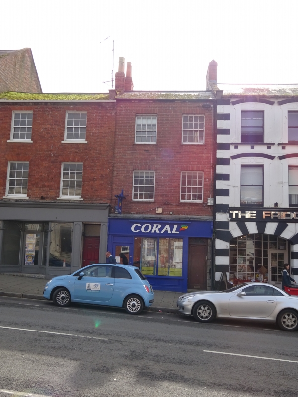
1.
5l91 WEST STREET
(South Side)
No 12
SY 4692 1/508
II GV
2.
Early C19, but 1st and 2nd floors rebuilt in replica after bomb damage in
2nd World War. Red brick. Ground floor of horizontally rusticated ashlar.
Pitched slate roof, with coped gables. 3 storeys. Door with 6 fielded panels
and oblong fanlight. Early C20 shopfront. 2 ranges of sashes with glazing
bars,
Nos 2 to 16 (even) form a group.
Listing NGR: SY4653792931
External links are from the relevant listing authority and, where applicable, Wikidata. Wikidata IDs may be related buildings as well as this specific building. If you want to add or update a link, you will need to do so by editing the Wikidata entry.


Other nearby listed buildings
