Approximate Location Map
Large Map »
Latitude: 50.7255 / 50°43'31"N
Longitude: -2.9411 / 2°56'27"W
OS Eastings: 333669
OS Northings: 92190
OS Grid: SY336921
Mapcode National: GBR PJ.CX40
Mapcode Global: FRA 47Q5.B08
Plus Code: 9C2VP3G5+6H
Entry Name: Kersbrook Cottage
Listing Date: 31 January 1974
Grade: II
Source: Historic England
Source ID: 1230049
English Heritage Legacy ID: 404889
ID on this website: 101230049
Location: Lyme Regis, Dorset, DT7
County: Dorset
Civil Parish: Lyme Regis
Built-Up Area: Lyme Regis
Traditional County: Dorset
Lieutenancy Area (Ceremonial County): Dorset
Church of England Parish: Lyme Regis St Michael the Archangel
Church of England Diocese: Salisbury
Tagged with: Cottage Thatched cottage
POUND ROAD
1.
1357
(West Side)
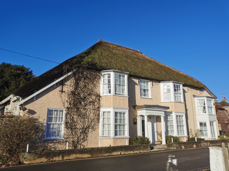
Kersbrook Cottage
SY 3392 3/77
II
2.
C18. 2 storeys. 5 window bays. Stuccoed. Hipped thatched roof. From left
to right hand end, outshut with a sash window on ground floor; splayed bay on
both floors with sash window in each light; porch with fluted columns; splayed
bay on both floors. Glazing bars intact.
Listing NGR: SY3366992190
External links are from the relevant listing authority and, where applicable, Wikidata. Wikidata IDs may be related buildings as well as this specific building. If you want to add or update a link, you will need to do so by editing the Wikidata entry.


Other nearby listed buildings
