Latitude: 50.7306 / 50°43'50"N
Longitude: -1.1626 / 1°9'45"W
OS Eastings: 459196
OS Northings: 92668
OS Grid: SZ591926
Mapcode National: GBR 9CN.0X1
Mapcode Global: FRA 87G4.T1N
Plus Code: 9C2WPRJP+6X
Entry Name: 49 and 50, Union Street
Listing Date: 18 May 1972
Grade: II
Source: Historic England
Source ID: 1239059
English Heritage Legacy ID: 416792
ID on this website: 101239059
Location: Ryde, Isle of Wight, PO33
County: Isle of Wight
Civil Parish: Ryde
Built-Up Area: Ryde
Traditional County: Hampshire
Lieutenancy Area (Ceremonial County): Isle of Wight
Church of England Parish: Ryde
Church of England Diocese: Portsmouth
Tagged with: Building
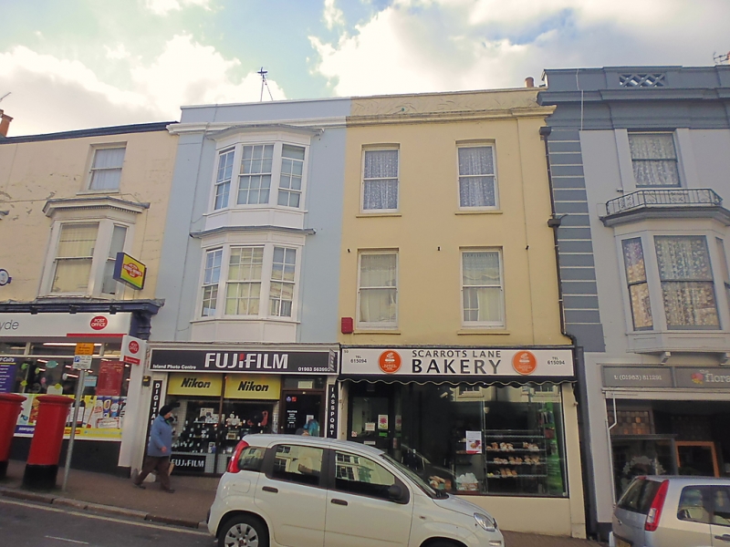
UNION STREET
1.
1577
(West Side)
Nos 49 & 50
SZ 5992 2/14
II GV
2.
One building. Early C19, Three storeys. Three windows. Stuccoed. Pilasters
flanking the front from first to second floor. Cornice and parapet. No 49
has a bay of three lights with pilasters between the lights and cornice over
(Blazing bars intact) on the first and second floors, Modern shop front.
Nos 44 to 53 (consec) form a group.
Listing NGR: SZ5918992671
External links are from the relevant listing authority and, where applicable, Wikidata. Wikidata IDs may be related buildings as well as this specific building. If you want to add or update a link, you will need to do so by editing the Wikidata entry.


Other nearby listed buildings