Latitude: 51.3592 / 51°21'32"N
Longitude: 1.4454 / 1°26'43"E
OS Eastings: 639964
OS Northings: 167868
OS Grid: TR399678
Mapcode National: GBR Y1L.L8H
Mapcode Global: VHMCX.03HD
Plus Code: 9F339C5W+M5
Entry Name: The Look out House and Stores, the Pier
Listing Date: 11 February 1969
Grade: II
Source: Historic England
Source ID: 1239626
English Heritage Legacy ID: 417596
ID on this website: 101239626
Location: Broadstairs, Thanet, Kent, CT10
County: Kent
District: Thanet
Civil Parish: Broadstairs and St. Peters
Built-Up Area: Broadstairs
Traditional County: Kent
Lieutenancy Area (Ceremonial County): Kent
Tagged with: Building
HARBOUR STREET 1. 5283 (North East Side) BROADSTAIRS The Look Out House and Stores, The Pier TR 3967 NE 1/8A 11.2.69. II GV
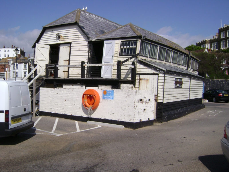
2. Late C18 to early C19, 2 storeys weatherboarded. 2 parallel ranges. The left side range has a half-hipped slate roof. The other range has a hipped slate roof. On the right hand side, facing the harbour is a 1st floor barn door and a wooden staircase leading up to it. Over this is a ship's figurehead, a bust of a Grecian warrior with lion skin. To the left hand side of the door is another figurehead of a Scotsman. The rear range has a continuous casement window. Depth gauge on the front elevation facing Harbour Street.
Group value with Admiralty Cottage.
Listing NGR: TR3996467868
External links are from the relevant listing authority and, where applicable, Wikidata. Wikidata IDs may be related buildings as well as this specific building. If you want to add or update a link, you will need to do so by editing the Wikidata entry.


Other nearby listed buildings