Latitude: 54.8708 / 54°52'14"N
Longitude: -1.753 / 1°45'10"W
OS Eastings: 415947
OS Northings: 552922
OS Grid: NZ159529
Mapcode National: GBR JD63.8R
Mapcode Global: WHC42.1THT
Plus Code: 9C6WV6CW+8Q
Entry Name: Harelaw Watering Place
Listing Date: 21 January 1987
Grade: II
Source: Historic England
Source ID: 1240896
English Heritage Legacy ID: 439465
ID on this website: 101240896
Location: Harelaw, County Durham, DH9
County: County Durham
Civil Parish: Stanley
Built-Up Area: Annfield Plain
Traditional County: Durham
Lieutenancy Area (Ceremonial County): County Durham
Church of England Parish: Harelaw and Annfield Plain
Church of England Diocese: Durham
Tagged with: Building
NZ 15 SE NZ 159529 STANLEY NORTH ROAD
(West side)
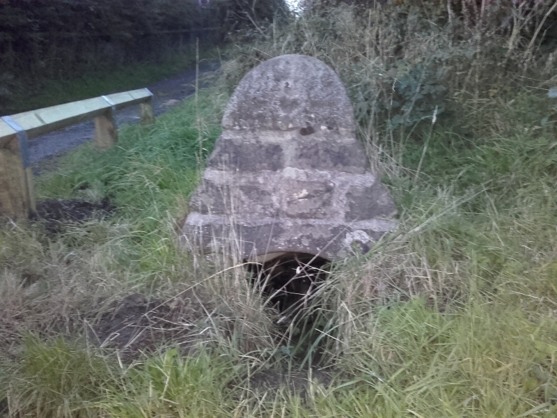
7/187 Harelaw Watering
Place
II
Spring head. Possibly C17. Coursed squared sandstone. Pyramid c.one metre
high, with rounded point and opening on south side with low segmental arch cut
in lintel; hole in lintel at right may have held chain.
Listing NGR: NZ1594752922
External links are from the relevant listing authority and, where applicable, Wikidata. Wikidata IDs may be related buildings as well as this specific building. If you want to add or update a link, you will need to do so by editing the Wikidata entry.


Other nearby listed buildings