Latitude: 54.2383 / 54°14'17"N
Longitude: -0.7165 / 0°42'59"W
OS Eastings: 483748
OS Northings: 483274
OS Grid: SE837832
Mapcode National: GBR RMFF.PF
Mapcode Global: WHF9X.YQZP
Plus Code: 9C6X67QM+89
Entry Name: Brook House
Listing Date: 5 February 1986
Grade: II
Source: Historic England
Source ID: 1241368
English Heritage Legacy ID: 440326
ID on this website: 101241368
Location: Thornton-le-Dale, North Yorkshire, YO18
County: North Yorkshire
District: Ryedale
Civil Parish: Thornton-le-Dale
Built-Up Area: Thornton-le-Dale
Traditional County: Yorkshire
Lieutenancy Area (Ceremonial County): North Yorkshire
Tagged with: House
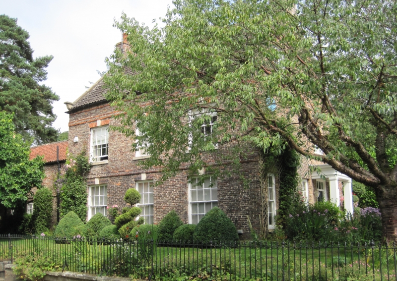
THORNTON DALE PRIESTMAN'S LANE SE 8383 (east side) 14/145 Brook House GV II House. Mid C18; extended late C18 and C20; remodelled C20. For the Priestman family. Rose and cream brick in garden wall bond, on stone plinth; orange-red brick dressings; timber porch; pantile roof. Originally central stairhall plan, 1½ rooms deep; later extended to left in two stages. 2-storey, 3-window front. Present entrance to right gable wall. Original entrance to centre of main front now blocked by 12-pane sash. Remaining windows are 16-pane sashes. Flat arches of gauged brick with stone tripartite keyblocks to all openings. Stone sills to all windows. Raised band of three courses of brick at first floor level and two similar bands below the stepped eaves course. Right gable wall: 6-panel door with divided overlight beneath C20 cornice porch on piers. Sashes to left are C20 insertions. Coped gables and shaped kneelers. End stacks.
Listing NGR: SE8374883274
External links are from the relevant listing authority and, where applicable, Wikidata. Wikidata IDs may be related buildings as well as this specific building. If you want to add or update a link, you will need to do so by editing the Wikidata entry.


Other nearby listed buildings