Approximate Location Map
Large Map »
Latitude: 51.2819 / 51°16'54"N
Longitude: 1.0753 / 1°4'30"E
OS Eastings: 614559
OS Northings: 158130
OS Grid: TR145581
Mapcode National: GBR TY2.GPV
Mapcode Global: VHLGM.L19M
Plus Code: 9F3373JG+Q4
Entry Name: 7, St Dunstan's Street
Listing Date: 3 May 1967
Grade: II
Source: Historic England
Source ID: 1241787
English Heritage Legacy ID: 441023
ID on this website: 101241787
Location: Canterbury, Kent, CT2
County: Kent
District: Canterbury
Electoral Ward/Division: Westgate
Parish: Non Civil Parish
Built-Up Area: Canterbury
Traditional County: Kent
Lieutenancy Area (Ceremonial County): Kent
Tagged with: Building
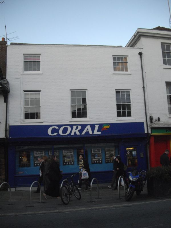
1.
944 ST DUNSTAN'S STREET
(North East Side)
No 7
TR 1458 SE 2/316 3.5.67.
II GV
2.
An C18 front to an older building. 3 storeys painted brick. Slate roof.
Rainwater head. 2 to 3 windows with glazing bars intact. Overhang of timber
framed building is visible, supported on brackets. Later shopfront.
Nos 5 to 16 (consec) form a group.
Listing NGR: TR1456058133
External links are from the relevant listing authority and, where applicable, Wikidata. Wikidata IDs may be related buildings as well as this specific building. If you want to add or update a link, you will need to do so by editing the Wikidata entry.


Other nearby listed buildings
