Approximate Location Map
Large Map »
Latitude: 52.8255 / 52°49'31"N
Longitude: -1.255 / 1°15'17"W
OS Eastings: 450299
OS Northings: 325594
OS Grid: SK502255
Mapcode National: GBR 8JZ.TSY
Mapcode Global: WHDHH.P7LQ
Plus Code: 9C4WRPGW+62
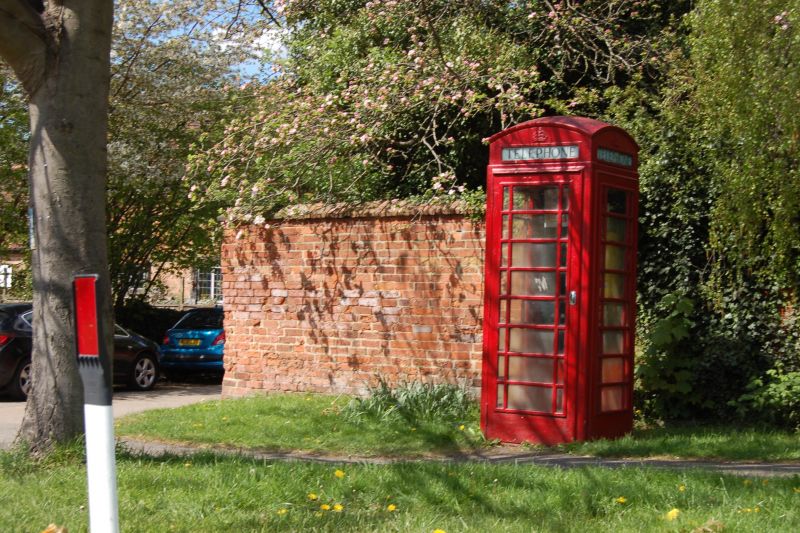
Entry Name: K6 Telephone Kiosk
Listing Date: 12 October 1987
Grade: II
Source: Historic England
Source ID: 1242542
English Heritage Legacy ID: 441976
ID on this website: 101242542
Location: Sutton Bonington, Rushcliffe, Nottinghamshire, LE12
County: Nottinghamshire
District: Rushcliffe
Civil Parish: Sutton Bonington
Traditional County: Nottinghamshire
Lieutenancy Area (Ceremonial County): Nottinghamshire
Church of England Parish: Sutton Bonington
Church of England Diocese: Southwell and Nottingham
Tagged with: K6 telephone box
SK 52 NW
4/156
SUTTON BONNINGTON
MARLEPIT HILL
K6 Telephone Kiosk
GV
II
Telephone kiosk. Type K6. Designed 1935 by Sir Giles Gilbert Scott. Made by
various contractors. Cast iron. Square kiosk with domed roof. Unperforated
crowns to top panels and margin glazing to windows and door.
Listing NGR: SK5029925594
External links are from the relevant listing authority and, where applicable, Wikidata. Wikidata IDs may be related buildings as well as this specific building. If you want to add or update a link, you will need to do so by editing the Wikidata entry.


Other nearby listed buildings
