Latitude: 51.0697 / 51°4'10"N
Longitude: -1.7914 / 1°47'29"W
OS Eastings: 414712
OS Northings: 130056
OS Grid: SU147300
Mapcode National: GBR 517.XK9
Mapcode Global: FRA 7649.7XS
Plus Code: 9C3W3695+VC
Entry Name: 57, Winchester Street
Listing Date: 12 October 1972
Grade: II
Source: Historic England
Source ID: 1243404
English Heritage Legacy ID: 447211
ID on this website: 101243404
Location: Salisbury, Wiltshire, SP1
County: Wiltshire
Civil Parish: Salisbury
Built-Up Area: Salisbury
Traditional County: Wiltshire
Lieutenancy Area (Ceremonial County): Wiltshire
Church of England Parish: Salisbury St Thomas and St Edmund
Church of England Diocese: Salisbury
Tagged with: Building
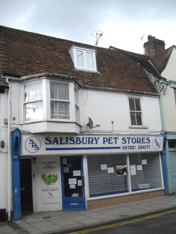
WINCHESTER STREET
1.
1594 (North Side)
No 57
SU 1430 SE 2/609
II GV
2.
C18/C19. 2 storeys painted brick. Steep mansard old tileroof. One dormer.
lst floor has Cl9 canted bay window to left, no glazing bars, flush framed
sash window to right. Ground floor altered Victorian shop front.
Nos 51 to 57 (odd) and the Anchor and Hope Public House form a group.
Listing NGR: SU1471230056
External links are from the relevant listing authority and, where applicable, Wikidata. Wikidata IDs may be related buildings as well as this specific building. If you want to add or update a link, you will need to do so by editing the Wikidata entry.


Other nearby listed buildings