Latitude: 51.07 / 51°4'11"N
Longitude: -1.7916 / 1°47'29"W
OS Eastings: 414696
OS Northings: 130090
OS Grid: SU146300
Mapcode National: GBR 517.XHW
Mapcode Global: FRA 7649.7TC
Plus Code: 9C3W3695+X9
Entry Name: 16-22, St Edmund's Church Street
Listing Date: 12 October 1972
Grade: II
Source: Historic England
Source ID: 1273206
English Heritage Legacy ID: 445896
ID on this website: 101273206
Location: Salisbury, Wiltshire, SP1
County: Wiltshire
Civil Parish: Salisbury
Built-Up Area: Salisbury
Traditional County: Wiltshire
Lieutenancy Area (Ceremonial County): Wiltshire
Church of England Parish: Salisbury St Thomas and St Edmund
Church of England Diocese: Salisbury
Tagged with: Building
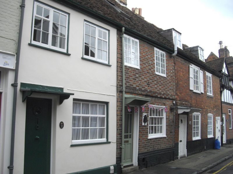
ST EDMUNDS CHURCH STREET
1.
1594 (East Side)
SU 1430 SE 2/249 Nos 16 to 22 (even)
II GV
2.
2 pairs of cottages. Nos 20 and 22 C18, 2 storeys and attic chequer brick,
No 22 stuccoed with new brick plinth. Gable end old tile roof. Formerly with
dormers. Each cottage has 2 2 light casements on 1st floor and one 5- paned
sash on ground floor. Formerly doors of 6 flush panels, altered No 20, modern
No 22 with small hoods.
Nos 16 and 18 C18/C19 2 storeys and attic, red brick. Gable end old tile roof.
Each cottage has one dormer and 2 tall 2 light casements each floor, one with
shutters. Doors to outer corners, one retains part of flush panelling, plain
surrounds, bracketed hood to No 18.
Nos 2 to 10 (even) and Nos 16 to 24 (even) with Methodist Church form a group.
Listing NGR: SU1469630090
External links are from the relevant listing authority and, where applicable, Wikidata. Wikidata IDs may be related buildings as well as this specific building. If you want to add or update a link, you will need to do so by editing the Wikidata entry.


Other nearby listed buildings