Latitude: 52.2474 / 52°14'50"N
Longitude: 0.7118 / 0°42'42"E
OS Eastings: 585220
OS Northings: 264494
OS Grid: TL852644
Mapcode National: GBR QF0.0SJ
Mapcode Global: VHKD4.9R4Z
Plus Code: 9F426PW6+XP
Entry Name: 6, St Johns Street
Listing Date: 12 July 1972
Grade: II
Source: Historic England
Source ID: 1245020
English Heritage Legacy ID: 467179
ID on this website: 101245020
Location: Bury St Edmunds, West Suffolk, IP33
County: Suffolk
District: West Suffolk
Civil Parish: Bury St Edmunds
Built-Up Area: Bury St Edmunds
Traditional County: Suffolk
Lieutenancy Area (Ceremonial County): Suffolk
Church of England Parish: Bury St Edmunds St John the Evangelist
Church of England Diocese: St.Edmundsbury and Ipswich
Tagged with: Building
BURY ST EDMUNDS
TL8564SW ST JOHN'S STREET 639-1/7/598 (West side) 12/07/72 No.6
GV II
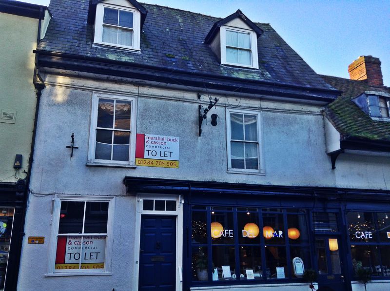
House; now shop and offices. C16 with C18 front and C19 alterations. Timber-framed and rendered; steeply-pitched slate roof with wide eaves and a moulded plaster cornice. L-shaped plan with a contemporary rear wing. EXTERIOR: 2 storeys and attics; 2 window range: sashes in flush cased frames with a single vertical glazing bar to lights. One similar window on the ground storey and a wide C19 double shop front with glazing bars which overlaps with the adjoining No.7 (qv). 2 gabled dormers have sashes with vertical glazing bars and plain bargeboards. A 6-panel door in a plain wood architrave has a rectangular fanlight with vertical glazing bars. A heavy blind box above the door and shop fascia and a scrolled cast-iron bracket for a hanging sign projecting between the upper windows. At the rear, the 2-storey timber-framed C16 wing is rendered and roughcast, with C20 plaintiles and an end chimney-stack. A small 2-storey C19 extension has a shallow-pitched slate roof. INTERIOR: no cellar. Front range originally jettied, in 2 wide bays, divided into 2 rooms with exposed main beams on the ground storey with shallow double roll mouldings. A similar moulding to the main beam in the rear wing. A beam with ogee moulding and a cresting which is set near the front wall of the northern bay may be a reversed fascia beam which covered the joist ends of the former jetty. The upper rooms are high, with only plain main ceiling beams exposed; a corner fireplace in one room. Plastered attics.
Listing NGR: TL8522064494
External links are from the relevant listing authority and, where applicable, Wikidata. Wikidata IDs may be related buildings as well as this specific building. If you want to add or update a link, you will need to do so by editing the Wikidata entry.


Other nearby listed buildings